
Talk:Mayon
| This is the talk page for discussing improvements to the Mayon article. This is not a forum for general discussion of the article's subject. |
Article policies
|
| Find sources: Google (books · news · scholar · free images · WP refs) · FENS · JSTOR · TWL |
| This article is written in Philippine English, which has its own spelling conventions (color, realize, center, travelled) and some terms that are used in it (including jeepney and cyberlibel) may be different or absent from other varieties of English. According to the relevant style guide, this should not be changed without broad consensus. |
| This It is of interest to the following WikiProjects: | |||||||||||||||||||||||||||||||
| |||||||||||||||||||||||||||||||


| A fact from this article was featured on Wikipedia's Main Page in the On this day section on February 1, 2011, February 1, 2014, February 1, 2021, and February 1, 2024. |
Untitled[edit]
Does the latest update on Aug 8th actually make sense? "The size of the rockfalls from the lava dome have grown considerably and are threatening to cause massive, if not lifelessly dangerous, damage across the Philippines." What is the "if not lifelessly dangerous" meant to mean? --Nunners 14:26, 8 August 2006 (UTC)
Formating bug[edit]
The insertion of the image of the major volcanos in the Philippines has led to the suppression of the bullet point markers in the main text. Anyone know a neat solution or workaround? DFH 15:46, 8 August 2006 (UTC)
- I see that this has since been fixed by rearranging the image position. Thanks. DFH 17:41, 8 August 2006 (UTC)
Leonard Kniaseff volcano[edit]
According to [1] the most recent eruption of the 200m high Leonard Kniaseff was 1,800 years B.P. (Before Present). I fail to see how this paucity of data should lead to it being classified as an "active" volcano. DFH 18:34, 9 August 2006 (UTC)
- Hello this is maybe the solution. - Darwinek 19:01, 9 August 2006 (UTC)
- Thanks for the link, which could even be used as the basis for a new article with the title Leonard Kniaseff volcano to distinguish it from any future article on Leonard Kniaseff himself. DFH 12:16, 10 August 2006 (UTC)
Mayon Volcano or Mayon volcano[edit]
Why does Volcano have a capital V in this page title? DFH 12:20, 10 August 2006 (UTC)
- Because the "river" in Amazon River is capitalized? --Howard the Duck 03:26, 13 August 2006 (UTC)
Current activity[edit]
Please date all new additions to the 2006 activity section, and if possible also cite the information source as a reference. DFH 13:34, 11 August 2006 (UTC)
The Danger Zones[edit]
Isn't it proper to include a discussion on the danger zones? Note that PhiVolcs discussed the idea of classifying the areas of and those surrounding the volcano. the first 6-kilometer radius is considered as the permanent danger zone, the 6-8 kilometer radius is a partially dangerous zone, etc. User: Tikboyblue 16:24, 15 August 2006
I heard it just erupted. Anyone have confirmation of this? ~ magbatz 02:08, 7 January 2007 (UTC)
- I just googled it and nothing came up. I tried everything. I looked on USGS too and there was nothing. I don't think so. Meldshal42Comments and SuggestionsMy Contributions 20:37, 11 April 2008 (UTC)
For a GA Push...[edit]
- References
- Copy-editing (I can do this)
Then:
- Apply for GA
I have reviewed this article and this appears to be all it needs at the moment. Meldshal42Comments and SuggestionsMy Contributions 20:32, 11 April 2008 (UTC)
Extra material from Stratovolcano[edit]
I moved specific material from that article to /Extra
Currently erupting[edit]
As of 17 December 2009 (today) Mayon is currently erupting. It is inaccurate to change the infobox today to read "currently erupting as of November 11th, 2009" Gubernatoria (talk) 23:19, 17 December 2009 (UTC)
- See WP:V, "The threshold for inclusion in Wikipedia is verifiability, not truth—that is, whether readers are able to check that material added to Wikipedia has already been published by a reliable source, not whether we think it is true." The article should reflect the info found in the cited supporting source and, where it matters, should give date and, possibly, time information. I've updated the article. Wtmitchell (talk) (earlier Boracay Bill) 22:00, 18 December 2009 (UTC)
2008 Eruption[edit]
An anonymous vandal keeps removing the following paragraph from the article saying that it is "not an eruption since it is not level 5". This is odd because Phivolcs considers it an eruption, plus the current eruption is not level 5 either. Perhaps the anonymous contributor might leave well alone in future, or risk being cited for edit-warring.
- 2008 eruption
- On August 10, 2008, a summit explosion ejected ash 200 metres above the summit, with the ash drifting ENE. In the weeks prior to the eruption, there was a visible glow within the crater, and increased seismicity.[1] Gubernatoria (talk) 06:42, 23 December 2009 (UTC)
What vandalism? Nowhere in the source does it say that it was an eruption. To quote in detail from the 'read more' link-
- Although no major eruption is indicated, steam and ash explosions may occur in the following days.
Add how not a single news agency brought up this very minor volcanic activity from 2008, it's very clear that it wasn't a noteworthy incident. --112.203.95.233 (talk) 09:57, 23 December 2009 (UTC)
- The cite has since been removed, but a recent version of this page cited this source (at the Smithsonian), which says, "Last Known Eruption: 2008". That seems to me to be a better fit for the "Last eruption" template parameter than what it has been replaced with. Say yes to WP:V and say no to WP:OR. Wtmitchell (talk) (earlier Boracay Bill) 23:23, 23 December 2009 (UTC)
The recent anonymous revandalisation again has been reverted. Gubernatoria (talk) 00:59, 24 December 2009 (UTC)
- Thanks to Wtmitchell, his source is a good one, that's what I'm looking for. Although Gubernatoria, I would highly appreciate it if you could stop calling me a vandal; I've never removed material without justification. Practice good faith please. --112.203.95.233 (talk) 02:06, 24 December 2009 (UTC)
You were not justified in removing that part of the article. Whether it was wanton anonymous vandalism or just ignorant anonymous vandalism on your part, it was unjustified removal of relevant factual material. Gubernatoria (talk) 04:35, 27 December 2009 (UTC)
- Back then, the provided source did not indicate that it was an eruption. Seeing how the upper level section says 'recorded eruptions', it was very well justified, and without that source the whole event does not have any reference. In fact as that section stands right now, '2008 activity' lacks the citations to show that it was an eruption.
- And once again, I am not a vandal. I've been able to justify every removal I did, it just happens that my bold edits conflict with yours. Deal with it and learn to collaborate instead of resorting to calling names on your fellow contributors. --112.203.95.233 (talk) 13:58, 28 December 2009 (UTC)
Note that this earlier version of the article cited this supporting source at the Smithsonian Museum of Natural History which characterizes the 2008 activity as an eruption (the "Last Known Eruption", in fact, which would make the current activity just "activity". That was removed in this edit, and "Last eruption" redone to refer to the current activity, supported by by Phivolcs sources which don't describe the current activity as an eruption. Wtmitchell (talk) (earlier Boracay Bill) 21:39, 28 December 2009 (UTC)
- Yes, when you mentioned that source I added it to the article. But Guber reverted it again and called it 'apparent vandalism'. Now it needs to be reintegrated into the article to show that the last eruption was in 2008.
- While we're at it, do we have another reliable source that says the volcano is currently erupting? Because as far as PHIVOLCS sources are concerned it's not until it reaches level 5. --112.203.95.233 (talk) 00:48, 29 December 2009 (UTC)
- "as far as PHIVOLCS sources are concerned it's not until it reaches level 5".[citation needed] Please give citation for this remark.Gubernatoria (talk) 01:27, 29 December 2009 (UTC)
- Look up, it's my first reply to you. And don't edit my comments. --112.203.95.233 (talk) 01:32, 29 December 2009 (UTC)
- Or if you want to go more specific, here are the alert levels for Mayon Volcano. See how it's only in level 5 where it is considered an eruption. --112.203.95.233 (talk) 01:35, 29 December 2009 (UTC)
- You misquote Phivolcs. There is a difference between an "eruption" and a "hazardous eruption". Level 5 is hoisted for "hazardous eruption", not for "eruption". Phivolcs has called the current type of event a "quiet eruption", or "quietly erupting". Gubernatoria (talk) 02:26, 29 December 2009 (UTC)
- 'Phivolcs has called the current type of event a "quiet eruption", or "quietly erupting".'[citation needed] Your turn for a citation. --112.203.95.233 (talk) 02:29, 29 December 2009 (UTC)
- It's in the article if you'd bother to look. Gubernatoria (talk) 02:35, 29 December 2009 (UTC)
- You must be alone in seeing your source then. Even Wtmitchell didn't spot the citation you're speaking of. --112.203.95.233 (talk) 02:39, 29 December 2009 (UTC)
- Looking over the article, I see that it does cite this source in support of describing the activity on July 14, 2006 as a "quiet" eruption. Looking at the cited source, I see that that Philippine Inquirer article did describe it that way. I do not see any indication that Phivolcs described it that way.
- looking at the Phivolcs Alert levels for Mayon Volcano page, I don't see anything below a level 5 alert called an eruption.
- If there is consensus that I should re-integrate the Last eruption info and cite from this earlier version of the article, I'll be happy to do so, but I don't want to get into the middle of an edit war over it. I won't object if someone else wants to re-integrate that. If the current activity quiets down without reaching the Alert Level 5 stage, I'll probably fact-tag Last eruption info in the infobox which is not supported by a citation of a source clearly supporting characterization of whatever event is named there as an eruption. Wtmitchell (talk) (earlier Boracay Bill) 04:28, 29 December 2009 (UTC)
- Already did, I fact-tagged it before your comment. Although your link on 'this earlier version of the article' isn't an earlier version, it's a citation. Which earlier version were you refering to? The one with this supporting source? --112.203.95.233 (talk) 04:53, 29 December 2009 (UTC)
- Apparently I grabbed the wrong link. I meant this one, I think. Wtmitchell (talk) (earlier Boracay Bill) 03:32, 30 December 2009 (UTC)
- Already did, I fact-tagged it before your comment. Although your link on 'this earlier version of the article' isn't an earlier version, it's a citation. Which earlier version were you refering to? The one with this supporting source? --112.203.95.233 (talk) 04:53, 29 December 2009 (UTC)
- You must be alone in seeing your source then. Even Wtmitchell didn't spot the citation you're speaking of. --112.203.95.233 (talk) 02:39, 29 December 2009 (UTC)
- "as far as PHIVOLCS sources are concerned it's not until it reaches level 5".[citation needed] Please give citation for this remark.Gubernatoria (talk) 01:27, 29 December 2009 (UTC)
Section breaker[edit]
Nevermind, I found new refs that show both the 2008 and 2009 activities are considered as eruptions. --112.203.95.233 (talk) 08:41, 29 December 2009 (UTC)
Guber, please stop removing the citations, they are needed to show the volcano is currently erupting. Going from the alert level chart of Mayon Volcano alone does not lead to a definite conclusion on whether the volcano's current activity can be considered an eruption, the citations include statements from PHIVOLCS representatives that show the present status of the volcano. --112.203.95.233 (talk) 09:28, 30 December 2009 (UTC)
Scientists Say Magma Continues to Build Up Inside Mayon Volcano[edit]
This American site: [Fox] has an article about the fact that magma continues to build up inside this volcano.Agre22 (talk) 17:33, 26 December 2009 (UTC)agre22
- "You might think it is taking a break but the volcano is still swelling," chief government volcanologist Renato Solidum said after the restive volcano emitted fewer ash emissions on Sunday 27 December than in previous days. [2] Gubernatoria (talk) 11:41, 27 December 2009 (UTC)
New 7 Wonders[edit]
Does the following sentence need to remain in the introduction, or can it now be deleted as out-of-date?
On October 13, 2008 it was included in New7Wonders of Nature Top 10 list. However, it did not make the cut to the Top 25 finalists, giving way to the Puerto Princesa Subterranean River, another site in the Philippines.
Gubernatoria (talk) 13:43, 28 December 2009 (UTC)
- I don't have a citation for the first phrase, but an Inquirer news article did mention that Mayon Volcano was in the first round of voting for the New7Wonders of Nature. [2] --112.203.95.233 (talk) 14:11, 30 December 2009 (UTC)
A-Class Nomination[edit]
Would two (or more) uninvolved and well-experienced editors please assess this article to see if it meets A-Class Criteria, and if not, what improvements are needed. Thanks. Gubernatoria (talk) 13:54, 28 December 2009 (UTC)
- The article is currently B-Class, the next step up is GA-Class. --112.203.95.233 (talk) 00:57, 29 December 2009 (UTC)
I think the article is now well-organised and essentially complete and worthy of consideration as A-Class. But like the previous commentator, I am not an uninvolved editor. Gubernatoria (talk) 01:10, 29 December 2009 (UTC)
- Quoting seav's comment in this section on Tambayan Philippines assessment -
- I agree with him, the 2009 activity section needs a clean-up now, we don't need daily updates about the volcano especially since it's mostly the same this past week. How about we do it like in the 2006 activity section? It only lists events wherein PHIVOLCS increased or decreased the alert level. Other notable events may include evacuations, casualties, etc. --112.203.95.233 (talk) 11:45, 30 December 2009 (UTC)
When I completed writing the 2006 activity section, it was after activity ceased, and a lot of daily material was removed at that stage. The volcano is currently erupting (effusing lava, ejecting ash, releasing sulphur dioxide = erupting), and there is a daily interest in the eruption. When current activity ceases is the time we have reduced the amount of content from a daily listing to a more generalised description, with past eruptions. That should still seem to be a suitable timeframe. Gubernatoria (talk) 13:36, 30 December 2009 (UTC)
- Alright, I can get behind this. Once its current activity reaches level 5 or it gradually dies down like last time, I expect the daily updates to be summarized like in 2006 activity. --112.203.95.233 (talk) 14:59, 30 December 2009 (UTC)
Legazpi City[edit]
Because Philippine cities often include vast tracts of rural areas, they are not "cities" in the usual urban sense of the word. Legally, Mayon forms the northern apex of Legazpi City. Therefore the argument about whether it is 12, 15, or 16 kilomotres from "Legazpi City" misses the legality. It could be beneficial to mention distance from the Capitol, or perhaps the airport, since these are specific locations and not diverse spreads like the legal entity of Legazpi City. I changed the reference in the article to match the legal reality. Gubernatoria (talk) 01:07, 29 December 2009 (UTC)
Currently erupting[edit]
Currently erupting references moved from info box: [3] [4][5] Gubernatoria (talk) 05:18, 30 December 2009 (UTC)
- They deserve to be in the article, same with the source from the Smithsonian for the 2008 activity. Not every reader will look into the talk page to read these references. --112.203.95.233 (talk) 09:31, 30 December 2009 (UTC)
Mayon did not wait for Phivolcs to hoist Alert Level 3. It was erupting before then. I am (again) removing your misinformation from the info box. People can look at the 2009 activity section to find verification, and use their common sense plus an english language dictionary. Gubernatoria (talk) 14:53, 30 December 2009 (UTC)
- Okay, fine, have it your way. I just hope the GA committee doesn't hold the same standards as me and Wtmitchell do when it comes to affirming verifiability. --112.203.95.233 (talk) 15:04, 30 December 2009 (UTC)
Do we really need two Lignon Hill photos?[edit]
-
 Airport Parking Area.jpg
 -
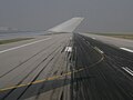 Runway.jpg


Guber wanted to keep Runway.jpg in article mainspace since it shows the "relationship between Mayon and Lignon Hill"... but there's already a picture in the gallery which shows the same scenery in better focus and with less Philippine Airlines advertising. --112.203.95.233 (talk) 12:04, 30 December 2009 (UTC)
10 July 2009 reference[edit]
The reference for the 10 July 2009 eruption was provided by me in my edit of 13:36 30 October 2009 which originally read:
- On 10 July 2009, PHIVOLCS issued the following bulletin:
- This is a notice for the raising of Mayon Volcano’s status from Alert Level 1 (low level unrest) to Alert Level 2 (moderate unrest).
- Beginning June 2009 monitored parameters indicated an increase in the current activity of Mayon Volcano. The number of recorded low frequency volcanic earthquakes rose to a higher level signifying possible movement of magma beneath the volcano edifice at shallow depth. The present seismic count is at the same level when a phreatic explosion occurred last August 2008. Ground uplift of about one centimeter was measured by Precise Leveling Survey conducted last June 15-22, 2009 and the uplift was sustained during a re-survey yesterday, July 9, 2009. Glow at the summit crater has intensified and could now be observed at Lignon Hill Observatory without the aid of telescopes. Steam emission was at moderate level.
- Aerial survey conducted last July 08, 2009, showed a cone-shaped pile of hot, steaming old rocks, possibly remnants from previous eruptions which could be the source of the glow at the crater. The low frequency volcanic earthquakes and ground uplift could indicate that fresh volcanic materials are moving upward at depth, causing the formation of the cone-shaped pile of materials at the crater.
- Because of the above observations, PHIVOLCS is now raising the Alert status of Mayon Volcano from Alert Level 1 to Alert Level 2. This alert condition signifies, a state of unrest which could lead to ash explosions or eventually to hazardous magmatic eruption. Thus, at Alert Level 2, PHIVOLCS strongly recommends that the 6-km radius Permanent Danger Zone (PDZ) around the volcano and the 7-km Extended Danger Zone (EDZ) on the southeast flank of the volcano are off-limits due to the threat from sudden explosions and rockfalls from the upper slopes. Active river channels and those areas perennially identified as lahar prone in the southeast sector should also be avoided especially during bad weather conditions or when there is heavy and prolonged rainfall. [6]
But some meddlesome interferor later removed the reference. Gubernatoria (talk) 15:05, 30 December 2009 (UTC)
- It looks to me as if you removed it yourself in this edit. Wtmitchell (talk) (earlier Boracay Bill) 20:29, 30 December 2009 (UTC)
I removed the blockquote but I did NOT remove the reference. The citation is still there in my edit 332991306. Gubernatoria (talk) 03:31, 31 December 2009 (UTC)
- It seems it got replaced by a volcano advisory about raising the alert level from level 2 to level 3. Not your fault though, the link is correct but the content was later changed on the PHIVOLCS website. --112.203.95.233 (talk) 03:41, 31 December 2009 (UTC)
- Found a copy of the original July 10, 2009 volcano bulletin on Google cache. --112.203.95.233 (talk) 03:57, 31 December 2009 (UTC)
- Right, Gubernatoria. I was going by the removed material having included "<ref name=PhilvocsBulletin>Mayon Volcano Bulletin 7, Philippine Institute of Volcanology and Seismology, 20 December 2009.</ref>", I didn't notice that the edit also showed this ref as having been reinserted. Perhaps something like http://www.abs-cbnnews.com/nation/regions/07/10/09/mayon-state-unrest-alert-level-raised would be a more stable supporting source for the raising of alert level 2. Wtmitchell (talk) (earlier Boracay Bill) 00:17, 1 January 2010 (UTC)
I've reinserted a link to the original reference and blockquote, plus your suggested ref Wtmitchell, plus the commercial ref provided by 112.203.95.233, which should cover all bases. Gubernatoria (talk) 15:51, 1 January 2010 (UTC)
- Your talk page citation has to go since you cannot use Wikipedia to cite Wikipedia itself. You should review Wikipedia policy on verifiability and self-references. --112.203.95.233 (talk) 16:08, 1 January 2010 (UTC)
Alert level 4 daily log[edit]
Will summarize this over the next day or so. --112.203.95.233 (talk) 08:17, 2 January 2010 (UTC)
---
On 21 December 2009, Phivolcs raised the status to Alert Level 4 meaning a hazardous explosive eruption is possible within days.[7]
On 22 December 2009 at 7am, Phivolcs noted an intense level of activity with an increase in sulphur dioxide emission to 6529 tonnes per day, lava flow down three separate gullies to a distance of 5 kilometres from the summit, 1266 volcanic earthquakes many at maximum deflection in the past 24 hours, audible booming and rumbling sounds, and intensified crater glow.[8]
On 23 December 2009 at 7am, Phivolcs noted 66 ash explosions had been observed in the previous 24 hours when visibility was good enough, producing grayish to light brown ash columns that reached heights of 100 to 1000 meters above the summit. Sulphur Dioxide emission increased slightly over the prior 24 hour period. 280 audible booming and rumbling sounds were intermittently heard in the previous 24 hours, while red hot lava continuously flowed down the Bonga-Buyuan, Miisi and Lidong gullies.[7]
On 24 December 2009, Phivolcs noted in the past 24 hours 21 ash explosions were observed, with the ash columns reaching heights of up to 1500 metres above the summit. Lava fountaining, reaching a maximum height of 500 meters above the crater rim was observed at 11.12pm, 11.14pm, 11.20pm and 11.32pm December 23, 2009. Sulphur dioxide emission was slightly lower than for the previous 24 hour period. In the 24 hour seismological recording period to 4.14pm 23 December, 815 volcanic earthquakes tremors were recorded, many at maximum deflection.[9]
On 25 December 2009, Phivolcs observed 96 ash explosions in the prior 24 hours reaching heights of up to 2000 metres. 125 rumbling and booming sounds were heard at the Lignon Hill Observatory. 871 volcanic earthquakes were recorded. 98 rock falls were noted related to detachment of lava fragments from the upper slopes. Three rockfalls generated pyroclastic flows which moved down about 2000 metres from the crater. Sulphur dioxide emission dropped to 2,738 tonnes for the previous day.[10]
On 26 December 2009, Phivolcs reported observing 33 dirty white to brownish ash columns reaching up to 1,000 metres above the summit. 26 rumbling and 2 hissing sounds were heard at Phivolcs' Lignon Hill Observatory. 406 volcanic earthquakes were recorded. 142 lava fragment rock falls were detected. Flowing red hot lava and rolling incandescent lava fragments were continuously observed at Bonga, Padang and Miisi gullies. Sulphur dioxide emission jumped to 8,993 tonnes for 25 December.[11]
On 27 December 2009, for the 24 hours to 7am, Phivolcs reported the eruption of 9 dirty white to brownish ash columns with lava fragments, which reached heights from 800 to 1000 metres above the summit. 7 of the ash eruptions occurred in less than 2 hours from 4.20am to 5.49am on 27 December. 44 volcanic earthquakes and 297 lava fragment rock falls were detected. Flowing red hot lava and rolling incandescent lava fragments temporarily slowed down after the 10.52am explosion earthquake on 26 December, with a concommitant decrease in sulphur dioxide emission rate from the previous 8,993 tonnes per day to 2,304 tonnes on 26 December. Lava flow resumed after the 4.20am 27 December ash ejection. Despite the high volume of lava extruded since the start of the eruption on 14 December, 2009, the magma chamber below the summit is still inflated, as indicated by electronic tilt meter measurements on the northwest slope at 800m ASL elevation.[12]
On 28 December 2009, for the 24 hours to 7am, Phivolcs reported observing 7 dirty white to light grey ash explosions reaching about 2000 metres above the summit. 44 volcanic earthquakes and 137 lava fragment rock falls were detected. Red hot lava continuously flowed down along the usual 3 gullies. Intermittent rolling of incandescent lava fragments was also observed. Sulphur dioxide emission rate increased to 4,329 tonnes per day.[13] The government's principal volcanologist, Renato Solidum, was reported to have said the previous afternoon on radio that the magma chamber is swelling. "You might think it is taking a break but the volcano is still swelling," [14] If the magma chamber is increasing in size, as is suggested by the quotation, this could be ominous of an impending major eruption.
On 29 December 2009, Phivolcs reported no significant variation from the previous day's report, but included a civil aviation warning for the first time.[15]
On 30 December 2009, Phivolcs reported a reduction in ash explosions to just one rising only 200 metres above the summit. Lava continued to flow down the usual three gullies, to about 5.9 kilometres from the summit down the Bonga-Buyuan gully. The number of volcanic earthquakes dropped to 16 from 38 for the previous 24 hour reporting period. Sulphur dioxide emission increased to 4397 tonnes from 3416 the previous day. The northeast electronic tilt meter shows the magma chamber remains inflated, although Phivolcs' bulletin has not reported any increase in the size of the inflation. [16]
On 31 December 2009, Phivolcs reported a further reduction in eruptive activity. No ash ejections were observed and only very weak to moderate white steam emissions were observed. Volcanic earthquakes dropped to 60 and sulphur dioxide emission decreased to 1158 tonnes for the 24 hour reporting period. The northeast electronic tilt meter continues to show the volcano is inflated with magma below the summit. [17] If Mayon follows its pattern of 2008, lava will continue to quietly erupt from the edifice until the magma chamber deflates, and activity will cease for this period. If Mayon follows its pattern of 1993, the current apparent quietening would be due to the vent becoming choked or plugged, and the vent would likely be unplugged by a spectacularly hazardous eruption. The key indicator is the tilt meter measurement of inflation on the northeast slope. While the volcano remains inflated, there is high risk of a hazardous eruption. If the current effusion of lava sufficiently deflates the magma chamber, it is most likely there will be no hazardous eruption in this eruptive cycle.
On 01 January 2010, Phivolcs reported a further reduction in eruptive activity. No ash ejection was observed and only weak to moderate emission of white steam at the summit crater was seen during cloudbreaks. Volcanic earthquakes dropped to 28. Lava continued to flow down the slopes from the summit but lava fragment rockfalls dropped to 91. Sulphur dioxide emission rate was about the same as the previous day at 1255 tonnes. Tilt meter readings were not mentioned in the Phivolcs bulletin.[18].
Summary[edit]
I have reduced the alert level 4 daily log from twelve paragraphs to two. For the first paragraph I used the one in the lead of the article which describes the start of alert level 4, while the second paragraph is a more detailed summary for the rest of alert level 4 from late December to the decrease to alert level 3 on January 2. I also included an estimate of the volcanic material erupted so far. --112.203.95.233 (talk) 03:28, 3 January 2010 (UTC)
As follows:
On December 20, 2009, PHIVOLCS raised Mayon's status level to alert level 4 because of an increasing lava flow in the southern portion of the volcano and an increase in sulphur dioxide emission to 750 tonnes per day. As well, almost 460 earthquakes in the volcano were monitored everyday. In the border of danger zone, rumbling sounds like thunder were also heard. Over 9,000 families (44,394 people) were evacuated by the Philippine government from the base of the volcano.[19] No civilian was permitted within the 8 kilometre danger zone, which has been cordoned off by the Philippine military, who were actively patrolling within the danger zone to enforce the "no-go" rule and to ensure no damage or loss of property of those evacuated. [14]
Alert level 4 was maintained as the volcano remained restive through the month of December, prompting affected residents to spend Christmas and the New Year in evacuation centers.[20] On December 25, sulfur dioxide emissions peaked at 8,993 tons per day.[11][21] On December 28, PHIVOLCS director Renato Solidum commented on the status of the volcano, "You might think it is taking a break but the volcano is still swelling."[14] On the next day December 29, a civil aviation warning for the airspace near the summit was included in the volcano bulletins.[15] The ejected volcanic material since the start of the eruption was estimated to have been between 20 million to 23 million cubic meters of rocks and volcanic debris, compared to 50 million to 60 million cubic meters in past eruptions.[22]
Last eruption[edit]
OK. The volcano seems to have quieted down for now. The last_eruption= parameter in the infobox says, "2010. Alert Level 1 (no hazardous eruption imminent) is in effect.", citing Mayon Volcano Bulletin March 2, 2010, 10:00 A.M., PHIVOLCS. However, AFAICS, that cited source does not support the characterization of the recent period of activity as an eruption.
This source, which has been cited in support of the content of this infobox field in versions of this article prior to the recent period of activity still says, "Last Known Eruption: 2009". So, the questions arise: (1) what date(s) should this article give for the last eruption, and (2) what supporting source(s) should be cited.
Editorial opinions? Comments? Wtmitchell (talk) (earlier Boracay Bill) 21:40, 11 March 2010 (UTC)
Having seen no comment, I've changed the last eruption date back to the cite-supported 2009 date. Wtmitchell (talk) (earlier Boracay Bill) 07:03, 14 March 2010 (UTC)
All opinions welcome. Thank you. walk victor falk talk 20:59, 5 April 2011 (UTC)
Cagsawa church[edit]
I saw this edit in passing. I don't have time to fiddle with this just now but it struck me that perhaps a citation or two might help. Sined themee the following, which I'll mention though I have not exam: [3], [4], [5], [6], [7], [8], [9], [10]. This tool (shown with example URL loaded) can be used to generate a fleshed-out cite from a Google Books URL. Wtmitchell (talk) (earlier Boracay Bill) 09:41, 7 April 2011 (UTC)
- Sorry I did that. It's more a common sense thing, the original caption credited it as a photo taken before the 1814 eruption, which is impossible, heh (the first photograph was taken in 1817). The main problem is that a lot of 'reliable' sources still claim that the rest of the Cagsawa church was completely "buried by lava", when it wasn't. Partially buried by ash or lahar maybe, but parts of the facade were still standing in at least 4 photographs I've seen, all of them pre-1950's and definitely post-1814. And I saw a claim that the rest of the ruins collapsed by earthquakes during the 1950's/subsequent eruptions and weren't buried à la Pompeii, as is supposed nowadays (unreliable though so I can't cite it *sigh*, but given the impossibility of the alternative theory, I think it should do for now). I've created an article on Cagsawa though. Needs a lot of work, and I've fact tagged the part on the purported time the rest of the structure of the ruins collapsed. But at least it isn't a copyvio like the last one, heh, maybe someone from Albay will see it and fix it. I've added it into the See also section here. If you'd like to add/improve the main article on it, see Cagsawa Ruins --Obsidi♠nSoul 11:02, 7 April 2011 (UTC)
- OK, but even given that please look at it in the light of the initial paragraph of WP:V and of WP:DUE. Where there's been a shift in the accepted analysis over time but the preponderance of sources out there still describe an older analysis now generally discredited, the (scant) more recent sources can be shielded from being overwhelmed by the (plentiful) older sources by structuring part of the article into separate subsections describing the separate views separately, and separately citing sources supporting the separate views. Apologies if these remarks aren't a 100% good fit here -- I still haven't taken time to look at this specific topic and the sources mentioned here (even by me) in any detail. Wtmitchell (talk) (earlier Boracay Bill) 11:26, 8 April 2011 (UTC)
- Yep, I've looked at all the sources I can get my hands on, actually. The links you gave also all say the same thing as the ones I've used. In the main article of the Cagsawa Ruins itself, I avoided mentioning exactly what happened to the church to keep within WP:NPOV, settling with weasel words instead. Bad, I know heh, but I have no objections to anyone correcting it with sourced info. I would welcome it in fact,
- But... not really sure, what you mean there. If you mean my change of the previous caption of the pic. Let me explain again. The old caption before my change was this:
- There is one thing immediately wrong about that, and it doesn't need a reliable source to tell you that it is wrong. A very simple thing: Photography (in the modern sense) wasn't invented until after 1814. You don't need a reliable source to tell you that a photo of the church before 1814 is impossible. The first ever photograph was made in 1817, three years after the Mayon eruption, the first ever permanent photograph was created in 1826, more than a decade later. And even then they were arcane instruments unlikely to ever fall into the hands of anyone visiting a Spanish colony halfway around the world.
- The second thing is this: The Cagsawa ruins today consist only of the belfry. You don't need a reliable source again to tell you that. The photos of it currently are enough. You will then come to two conclusions:
- The photo was taken after the 1814 eruption. Much much later in fact, to the time when cameras became more commonplace.
- The ruins consisted of more than just the belfry before, as the facade is clearly visible in not just one but several other photos.
- Compare the two pictures:

- So yeah, I had to change it. While I can not find the sources to fully cement the reasons behind my change, I simply can not leave the caption as is with a very obvious error on it. The Cagsawa ruins are quite iconic in the Philippines, it's immediately recognizable from textbook pictures and postcards of Mayon which almost always includes it in the foreground (though most Filipinos not from Albay don't know what it's actually called).--Obsidi♠nSoul 12:11, 8 April 2011 (UTC)
- RE "[not sure] what you mean there", above. If you're referring to what I said about finessing WP:DUE in a special case, I was wikilawyering off the top of my head -- something said previously here made me think that special case (a clash between lots of sources supporting outdated expert opinion vs. few sources supporting a more current consensus of experts) might apply here. Again, I haven't looked closely at the specifics here (and I should have, before commenting, but I've just got too much else on my plate right now). How to fit that smoothly into a particular case can get complicated. From an image caption, I might footnote a clarifying note containing a brief explanation and referring/wikilinking/linking to article subsections, to other articles and/or or outside sources for more detail. Wtmitchell (talk) (earlier Boracay Bill) 17:05, 8 April 2011 (UTC)
I uploaded this version:

SpeakFree (talk) 19:10, 27 April 2011 (UTC)
References[edit]
- ^ Taal Volcano Advisory, Philippine Institute of Volcanology and Seismology, 28 August 2008
- ^ http://inquirer.net/specialreports/volcanomonitor/view.php?db=1&article=20091227-244179 Inquirer Volcano Monitor
- ^ "Nearly 47,000 Filipinos move away from erupting Mayon Volcano". FOX News Network, LLC. 2009-12-22. Retrieved 2009-12-29.
- ^ Papa, Alcuin and Evangelista, Katherine (2009-12-18). "More ash, quakes, lava flow from Mayon—Phivolcs". Philippine Daily Inquirer. Retrieved 2009-12-29.
{{cite web}}: CS1 maint: multiple names: authors list (link) - ^ "Thicker lava flowing from Mayon's crater". ABS-CBN News. 2009-12-19. Retrieved 2009-12-29.
- ^ Mayon Volcano Advisory
- ^ a b Cite error: The named reference
PhivolcsBulletin10was invoked but never defined (see the help page). - ^ "Mayon Volcano Bulletin 9". Philippine Institute of Volcanology and Seismology. 2009-12-22. Retrieved 2009-12-22.
- ^ "Mayon Volcano Bulletin 11". Philippine Institute of Volcanology and Seismology. 2009-12-24. Retrieved 2009-12-24.
- ^ "Mayon Volcano Bulletin 12". Philippine Institute of Volcanology and Seismology. 2009-12-25. Retrieved 2009-12-25.
- ^ a b "Mayon Volcano Bulletin 13". Philippine Institute of Volcanology and Seismology. 2009-12-26. Retrieved 2009-12-26.
- ^ "Mayon Volcano Bulletin 14". Philippine Institute of Volcanology and Seismology. 2009-12-27. Retrieved 2009-12-27.
- ^ "Mayon Volcano Bulletin 15". Philippine Institute of Volcanology and Seismology. 2009-12-28. Retrieved 2009-12-28.
- ^ a b c "Inquirer Volcano Monitor 2009-12-27". Philippines Daily Inquirer. 2009-12-27. Retrieved 2009-12-27. Cite error: The named reference "InquirerVolcanoMonitor2009-12-27" was defined multiple times with different content (see the help page).
- ^ a b "Mayon Volcano Bulletin 16". Philippine Institute of Volcanology and Seismology. 2009-12-29. Retrieved 2009-12-29.
- ^ "Mayon Volcano Bulletin 17". Philippine Institute of Volcanology and Seismology. 2009-12-30. Retrieved 2009-12-30.
- ^ "Mayon Volcano Bulletin 18". Philippine Institute of Volcanology and Seismology. 2009-12-31. Retrieved 2009-12-31.
- ^ "Mayon Volcano Bulletin 19". Philippine Institute of Volcanology and Seismology. 2010-01-01. Retrieved 2010-01-01.
- ^ "Volcano spews lava as eruption looms". CNN World. 2009-12-22. Retrieved 2009-12-24.
- ^ Papa, Alcuin and Nasol, Rey M. (2010-01-01). "Mayon quieting down". Philippine Daily Inquirer. Retrieved 2010-01-02.
{{cite web}}: CS1 maint: multiple names: authors list (link) - ^ Cite error: The named reference
PhivolcsBulletin20was invoked but never defined (see the help page). - ^ Flores, Helen (2010-01-02). "Phivolcs may lower Mayon alert level". The Philippine Star. Retrieved 2010-01-02.
External links modified[edit]
Hello fellow Wikipedians,
I have just modified 2 external links on Mayon Volcano. Please take a moment to review my edit. If you have any questions, or need the bot to ignore the links, or the page altogether, please visit this simple FaQ for additional information. I made the following changes:
- Added archive http://web.archive.org/web/20131219210240/http://pawb.gov.ph/index.php?option=com_content&view=article&id=65:region-5&catid=69:regions to http://pawb.gov.ph/index.php?option=com_content&view=article&id=65:region-5&catid=69:regions
- Added
{{dead link}}tag to http://modis.higp.hawaii.edu/cgi-bin/modis/modisnew.cgi - Added archive https://web.archive.org/web/20080125115718/http://www.cnn.com/2006/WEATHER/12/01/philippines.typhoon/index.html to http://www.cnn.com/2006/WEATHER/12/01/philippines.typhoon/index.html
When you have finished reviewing my changes, please set the checked parameter below to true or failed to let others know (documentation at {{Sourcecheck}}).
This message was posted before February 2018. After February 2018, "External links modified" talk page sections are no longer generated or monitored by InternetArchiveBot. No special action is required regarding these talk page notices, other than regular verification using the archive tool instructions below. Editors have permission to delete these "External links modified" talk page sections if they want to de-clutter talk pages, but see the RfC before doing mass systematic removals. This message is updated dynamically through the template {{source check}} (last update: 18 January 2022).
- If you have discovered URLs which were erroneously considered dead by the bot, you can report them with this tool.
- If you found an error with any archives or the URLs themselves, you can fix them with this tool.
Cheers.—InternetArchiveBot (Report bug) 18:45, 20 July 2016 (UTC)
External links modified[edit]
Hello fellow Wikipedians,
I have just modified 3 external links on Mayon Volcano. Please take a moment to review my edit. If you have any questions, or need the bot to ignore the links, or the page altogether, please visit this simple FaQ for additional information. I made the following changes:
- Added archive https://web.archive.org/web/20081202103819/http://volcano.phivolcs.dost.gov.ph:80/update_VMEPD/Volcano/VolcanoList/mayon.htm to http://volcano.phivolcs.dost.gov.ph/update_VMEPD/Volcano/VolcanoList/mayon.htm
- Added
{{dead link}}tag to http://webcache.googleusercontent.com/search?q=cache:4hTacnvPhJ8J:www.phivolcs.dost.gov.ph/index.php%3Foption%3Dcom_content%26task%3Dview%26id%3D188%26Itemid%3D1 - Added archive https://web.archive.org/web/20110704135457/http://210.185.184.53/ndccWeb/images/ndccWeb/ndcc_update/Mt_Mayon/JANUARY_2010/ndcc%20update%20sitrep%20no.%2022%20re%20mayon%20volcano%20as%20of%2003%20jan%202010,%207am.pdf to http://210.185.184.53/ndccWeb/images/ndccWeb/ndcc_update/Mt_Mayon/JANUARY_2010/ndcc%20update%20sitrep%20no.%2022%20re%20mayon%20volcano%20as%20of%2003%20jan%202010%2C%207am.pdf
- Corrected formatting/usage for http://www.cnn.com/2006/WEATHER/12/01/philippines.typhoon/index.html
When you have finished reviewing my changes, please set the checked parameter below to true or failed to let others know (documentation at {{Sourcecheck}}).
This message was posted before February 2018. After February 2018, "External links modified" talk page sections are no longer generated or monitored by InternetArchiveBot. No special action is required regarding these talk page notices, other than regular verification using the archive tool instructions below. Editors have permission to delete these "External links modified" talk page sections if they want to de-clutter talk pages, but see the RfC before doing mass systematic removals. This message is updated dynamically through the template {{source check}} (last update: 18 January 2022).
- If you have discovered URLs which were erroneously considered dead by the bot, you can report them with this tool.
- If you found an error with any archives or the URLs themselves, you can fix them with this tool.
Cheers.—InternetArchiveBot (Report bug) 01:06, 9 November 2016 (UTC)
Requested move 23 December 2016[edit]
- The following is a closed discussion of a requested move. Please do not modify it. Subsequent comments should be made in a new section on the talk page. Editors desiring to contest the closing decision should consider a move review. No further edits should be made to this section.
The result of the move request was: pages moved as there is a clear consensus for a primary topic. (non-admin closure) Merry Christmas and Happy New Year, GeoffreyT2000 (talk, contribs) 23:09, 30 December 2016 (UTC)
– WP:Concise and WP:Commonname: The article uses both "Mount Mayon" and "Mayon Volcano", however, the only consistent name used throughout is the name without a modifier, simply Mayon. All three names are common but the single name may be the most common of the three. WP:Primary topic: The only other similarly named article is Mayon, Cornwall which is receiving significantly less views than this article. Shhhhwwww!! (talk) 22:25, 23 December 2016 (UTC)
- Support, for once there really is a primary topic that passes both parts of the guideline. In ictu oculi (talk) 20:32, 24 December 2016 (UTC)
- Support per WP:Primary topic. - Darwinek (talk) 18:48, 25 December 2016 (UTC)
- The above discussion is preserved as an archive of a requested move. Please do not modify it. Subsequent comments should be made in a new section on this talk page or in a move review. No further edits should be made to this section.
External links modified[edit]
Hello fellow Wikipedians,
I have just modified 9 external links on Mayon. Please take a moment to review my edit. If you have any questions, or need the bot to ignore the links, or the page altogether, please visit this simple FaQ for additional information. I made the following changes:
- Added archive https://archive.is/20120715153304/http://volcanoes.usgs.gov/Imgs/Jpg/Mayon/-020_caption.html to http://volcanoes.usgs.gov/Imgs/Jpg/Mayon/-020_caption.html
- Added archive https://web.archive.org/web/20110807132405/http://www.inquirer.net/specialreports/volcanomonitor/view.php?db=1&article=20091028-232734 to http://inquirer.net/specialreports/volcanomonitor/view.php?db=1&article=20091028-232734
- Added archive https://web.archive.org/web/20110807132423/http://www.inquirer.net/specialreports/volcanomonitor/view.php?db=1&article=20091215-242177 to http://inquirer.net/specialreports/volcanomonitor/view.php?db=1&article=20091215-242177
- Added archive https://web.archive.org/web/20110807132441/http://www.inquirer.net/specialreports/volcanomonitor/view.php?db=1&article=20091218-242651 to http://inquirer.net/specialreports/volcanomonitor/view.php?db=1&article=20091218-242651
- Added archive https://web.archive.org/web/20110807132457/http://www.inquirer.net/specialreports/volcanomonitor/view.php?db=1&article=20091227-244179 to http://inquirer.net/specialreports/volcanomonitor/view.php?db=1&article=20091227-244179
- Added archive https://web.archive.org/web/20100103112856/http://newsinfo.inquirer.net/inquirerheadlines/nation/view/20100101-245096/Mayon-quieting-down to http://newsinfo.inquirer.net/inquirerheadlines/nation/view/20100101-245096/Mayon-quieting-down
- Added archive https://web.archive.org/web/20110607104054/http://www.mb.com.ph/articles/236658/worst-over-mayon to http://www.mb.com.ph/articles/236658/worst-over-mayon
- Added archive https://web.archive.org/web/20091227204452/http://newsinfo.inquirer.net/inquirerheadlines/regions/view/20091227-244111/Mayon-instruments-intact-despite-eruption to http://newsinfo.inquirer.net/inquirerheadlines/regions/view/20091227-244111/Mayon-instruments-intact-despite-eruption
- Added archive https://web.archive.org/web/20120319105953/http://www.worldisround.com/articles/53247/photo49.html to http://www.worldisround.com/articles/53247/photo49.html
When you have finished reviewing my changes, you may follow the instructions on the template below to fix any issues with the URLs.
This message was posted before February 2018. After February 2018, "External links modified" talk page sections are no longer generated or monitored by InternetArchiveBot. No special action is required regarding these talk page notices, other than regular verification using the archive tool instructions below. Editors have permission to delete these "External links modified" talk page sections if they want to de-clutter talk pages, but see the RfC before doing mass systematic removals. This message is updated dynamically through the template {{source check}} (last update: 18 January 2022).
- If you have discovered URLs which were erroneously considered dead by the bot, you can report them with this tool.
- If you found an error with any archives or the URLs themselves, you can fix them with this tool.
Cheers.—InternetArchiveBot (Report bug) 13:11, 3 September 2017 (UTC)
External links modified (January 2018)[edit]
Hello fellow Wikipedians,
I have just modified 4 external links on Mayon. Please take a moment to review my edit. If you have any questions, or need the bot to ignore the links, or the page altogether, please visit this simple FaQ for additional information. I made the following changes:
- Added archive https://web.archive.org/web/20130618122201/http://www.interaksyon.com/article/61447/bodies-of-4-mayon-volcano-hikers-arrive-in-manila to http://www.interaksyon.com/article/61447/bodies-of-4-mayon-volcano-hikers-arrive-in-manila
- Added archive https://web.archive.org/web/20130517001442/http://www.interaksyon.com/article/61233/bodies-of-5-missing-hikers-spotted-in-mayon-volcano to http://www.interaksyon.com/article/61233/bodies-of-5-missing-hikers-spotted-in-mayon-volcano
- Added archive https://web.archive.org/web/20130609014429/http://www.interaksyon.com/article/61316/rescuers-unable-to-bring-down-remains-of-5-mayon-mountaineers to http://www.interaksyon.com/article/61316/rescuers-unable-to-bring-down-remains-of-5-mayon-mountaineers
- Added archive https://web.archive.org/web/20130511011019/http://www.interaksyon.com/article/61288/last-thai-survivor-rescued-from-mayon to http://www.interaksyon.com/article/61288/last-thai-survivor-rescued-from-mayon
When you have finished reviewing my changes, you may follow the instructions on the template below to fix any issues with the URLs.
This message was posted before February 2018. After February 2018, "External links modified" talk page sections are no longer generated or monitored by InternetArchiveBot. No special action is required regarding these talk page notices, other than regular verification using the archive tool instructions below. Editors have permission to delete these "External links modified" talk page sections if they want to de-clutter talk pages, but see the RfC before doing mass systematic removals. This message is updated dynamically through the template {{source check}} (last update: 18 January 2022).
- If you have discovered URLs which were erroneously considered dead by the bot, you can report them with this tool.
- If you found an error with any archives or the URLs themselves, you can fix them with this tool.
Cheers.—InternetArchiveBot (Report bug) 06:08, 23 January 2018 (UTC)
2018 activity or 2018 eruptions[edit]
I think that section should be eruptions since the activity of the volcano is just eruptions. Itsquietuptown (talk) 11:59, 27 January 2018 (UTC)
'no i think it should not because volcano doesn't erupt daily like for example: first was inflation , 2nd days was only smoke's' Yournewsboy (talk) 10:37, 30 January 2018 (UTC)
Semi-protected edit request on 29 January 2018[edit]
This edit request has been answered. Set the |answered= or |ans= parameter to no to reactivate your request. |
Bitwitch08 (talk) 19:29, 29 January 2018 (UTC)
Please change, Mayon Volcano is always been and will always be in Legazpi Albay not in Naga City, it can be seen in Naga but it's far from Naga. Please correct. Here's the link to prove Mayon Volcano is in Legazpi Albay that includes google map. Please correct, Mayon Volcano is in Province of Legazpi Albay. https://www.google.com/maps/place/Mayon+Volcano/@13.5484293,118.2409828,5.75z/data=!4m8!1m2!2m1!1sPhilippines+government+%2B+mayon+volcano!3m4!1s0x33a1a9954fa1731f:0xdff71d3eddd0ea0d!8m2!3d13.254832!4d123.6861124 https://www.britannica.com/place/Mayon-Volcano https://geographic.org/geographic_names/name.php?uni=-3362132&fid=5014&c=philippines
Full Name (see definition): Mayon Volcano
Primary Country Code (see definition): RP (Philippines)
First-order administrative division code (see definition): 05 (Albay )
Region Font Code (see definition): 5 (Asia/Pacific)
Unique Feature Identifier (see definition): -2439611
Unique Name Identifier (see definition): -3362132
Latitude in decimal degrees (see definition): 13.255278
Longitude in decimal degrees (see definition): 123.686389
Latitude in degrees, minutes, and seconds (see definition): 13° 15' 19" N
Longitude in degrees, minutes, and seconds (see definition): 123° 41' 11" E
Military Grid Reference System coordinates (see definition): 51PWQ7435865468
Joint Operations Graphic reference (see definition): ND51-11
 Done, mostly. Someone went through and did subtle vandalism to this whole article so if I missed something please let me know. —KuyaBriBriTalk 20:36, 29 January 2018 (UTC)
Activities[edit]
there's already alot of activities must be added because of recent Catastrophic
Please semi-protect this article[edit]
Due to the recent vandalism activities done by a presumably not yet autoconfirmed user, I believe we should semi-protect this page to prevent vandalism. Itsquietuptown (talk) 06:51, 11 February 2018 (UTC)
A Commons file used on this page has been nominated for deletion[edit]
The following Wikimedia Commons file used on this page has been nominated for deletion:
Participate in the deletion discussion at the nomination page. —Community Tech bot (talk) 06:28, 2 April 2019 (UTC)
Commons files used on this page or its Wikidata item have been nominated for deletion[edit]
The following Wikimedia Commons files used on this page or its Wikidata item have been nominated for deletion:
Participate in the deletion discussion at the nomination page. —Community Tech bot (talk) 22:24, 8 March 2021 (UTC)
A Commons file used on this page or its Wikidata item has been nominated for deletion[edit]
The following Wikimedia Commons file used on this page or its Wikidata item has been nominated for deletion:
Participate in the deletion discussion at the nomination page. —Community Tech bot (talk) 02:24, 11 March 2021 (UTC)
- Wikipedia articles that use Philippine English
- B-Class vital articles
- Wikipedia level-5 vital articles
- Wikipedia vital articles in Geography
- B-Class level-5 vital articles
- Wikipedia level-5 vital articles in Geography
- B-Class vital articles in Geography
- B-Class WikiProject Volcanoes articles
- Top-importance WikiProject Volcanoes articles
- All WikiProject Volcanoes pages
- B-Class Philippine-related articles
- Top-importance Philippine-related articles
- WikiProject Philippines articles
- B-Class Mountain articles
- High-importance Mountain articles
- All WikiProject Mountains pages
- Selected anniversaries (February 2011)
- Selected anniversaries (February 2014)
- Selected anniversaries (February 2021)
- Selected anniversaries (February 2024)