Lavia, Finland
You can help expand this article with text translated from the corresponding article in Finnish. (June 2023) Click [show] for important translation instructions.
|
Lavia | |
|---|---|
Former municipality | |
| Lavian kunta Lavia kommun | |
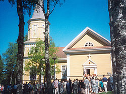
 Lavia Church | |
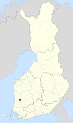
 Location of Lavia in Finland | |
| Coordinates: 61°36′N 022°35′E / 61.600°N 22.583°E | |
| Country | Finland |
| Region | Satakunta |
| Sub-region | Northern Satakunta sub-region |
| Charter | 1868 |
| Merged | 2015 |
| Government | |
| • Municipal manager | Pekka Heinonen |
| Area | |
| • Total | 357.75 km2 (138.13 sq mi) |
| • Land | 321.13 km2 (123.99 sq mi) |
| • Water | 36.62 km2 (14.14 sq mi) |
| Population (2014-11-30)[2] | |
| • Total | 1,904 |
| • Density | 5.3/km2 (14/sq mi) |
| Time zone | UTC+2 (EET) |
| • Summer (DST) | UTC+3 (EEST) |
| Website | www |
Lavia is a former municipality in the region of Satakunta, in Finland. It was merged with the city of Pori on 1 January 2015.
The municipality was unilingually Finnish.
People born in Lavia[edit]
- Frans Mustasilta (1879 – 1949)
- Arvo Riihimäki (1891 – 1972)
- Pentti Antila (1926 – 1997)
- Jaakko Jonkka (1953 – 2022)
References[edit]
- ^ "Area by municipality as of 1 January 2011" (PDF) (in Finnish and Swedish). Land Survey of Finland. Retrieved 9 March 2011.
- ^ "VÄESTÖTIETOJÄRJESTELMÄ REKISTERITILANNE 30.11.2014" (in Finnish and Swedish). Population Register Center of Finland. Archived from the original on 4 March 2016. Retrieved 29 December 2014.
External links[edit]
 Media related to Lavia at Wikimedia Commons
- Official website (in Finnish)


