
Belleville, Pennsylvania
Belleville | |
|---|---|
 Community Center | |
 Belleville Location within the U.S. state of Pennsylvania | |
| Coordinates: 40°36′12″N 77°43′29″W / 40.60333°N 77.72472°W | |
| Country | United States |
| State | Pennsylvania |
| County | Mifflin |
| Area | |
| • Total | 2.00 sq mi (5.17 km2) |
| • Land | 2.00 sq mi (5.17 km2) |
| • Water | 0.00 sq mi (0.00 km2) |
| Population | |
| • Total | 1,947 |
| • Density | 975.45/sq mi (376.67/km2) |
| Time zone | UTC-5 (Eastern (EST)) |
| • Summer (DST) | UTC-4 (EDT) |
| ZIP codes | 17004 |
| Area code | 717 |
| GNIS feature ID | 42-05304 |
Belleville is a census-designated place (CDP) in the Kishacoquillas Valley of Mifflin County, Pennsylvania, United States. The population was 1,827 at the 2010 census. Much of the population is Amish or Mennonite.[3]
History[edit]
Amish settled in the area by 1791. Mennonites arrived soon after and the two groups dominate the area's population. Though some Amish churches in the area allow members to drive motorized vehicles, most local Amish drive horse-powered buggies. The color of the buggy tops, yellow, white, or black, indicate the owner's church membership.[3]
The auction in Belleville is a popular destination every Wednesday. Locally grown produce, homemade baked goods, and farm-raised animals are available. A flea market is held at the same time.[3]
Children attend schools in the Mifflin County School District.
-
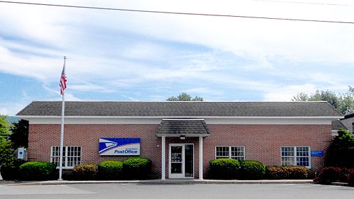 Post Office, ZIP code 17004

Belleville is the place where World champion Horseshoe pitcher Darle Esh was born. He was classed in the top 3% in the world.
Geography[edit]
.jpg)


Belleville is located at 40°36′12″N 77°43′29″W / 40.60333°N 77.72472°W (40.603376, -77.724822).[4] Pennsylvania Route 655 is known as Main Street within the village, with residences and a few businesses spread out within about two blocks of Main Street.
According to the United States Census Bureau, the CDP has a total area of 2.1 square miles (5.4 km2), all land.
Demographics[edit]
| Census | Pop. | Note | %± |
|---|---|---|---|
| 2020 | 1,947 | — | |
| U.S. Decennial Census[5][2] | |||
As of the census[6] of 2000, there were 1,386 people, 572 households, and 407 families residing in the CDP. The population density was 667.4 inhabitants per square mile (257.7/km2). There were 589 housing units at an average density of 283.6 per square mile (109.5/km2). The racial makeup of the CDP was 99.64% White, 0.07% African American, 0.07% Native American, 0.14% Asian, and 0.07% from two or more races. Hispanic or Latino of any race were 0.36% of the population.
There were 572 households, out of which 27.1% had children under the age of 18 living with them, 62.2% were married couples living together, 6.3% had a female householder with no husband present, and 28.7% were non-families. 26.9% of all households were made up of individuals, and 14.0% had someone living alone who was 65 years of age or older. The average household size was 2.42 and the average family size was 2.93.
In the CDP, the population was spread out, with 24.3% under the age of 18, 5.6% from 18 to 24, 24.9% from 25 to 44, 25.0% from 45 to 64, and 20.2% who were 65 years of age or older. The median age was 42 years. For every 100 females, there were 90.1 males. For every 100 females age 18 and over, there were 86.3 males.
The median income for a household in the CDP was $34,352, and the median income for a family was $40,096. Males had a median income of $32,933 versus $21,490 for females. The per capita income for the CDP was $15,202. About 2.0% of families and 6.1% of the population were below the poverty line, including 5.2% of those under age 18 and 9.1% of those age 65 or over.
See also[edit]
References[edit]
- ^ "ArcGIS REST Services Directory". United States Census Bureau. Retrieved October 12, 2022.
- ^ a b "Census Population API". United States Census Bureau. Retrieved October 12, 2022.
- ^ a b c National Geographic Society, Book Division (1998). "Big Valley Amish". America's Hidden Corners. pp. 77–80. ISBN 0-7922-7210-2.
- ^ "US Gazetteer files: 2010, 2000, and 1990". United States Census Bureau. February 12, 2011. Retrieved April 23, 2011.
- ^ "Census of Population and Housing". Census.gov. Retrieved June 4, 2016.
- ^ "U.S. Census website". United States Census Bureau. Retrieved January 31, 2008.
Municipalities and communities of Mifflin County, Pennsylvania, United States | ||
|---|---|---|
| Boroughs |  | |
| Townships | ||
| CDPs | ||
| Unincorporated communities | ||
| International | |
|---|---|
| National | |