
Dogonbadan
Dogonbadan
Persian: دوگنبدان | |
|---|---|
City | |
 Panorama of Dogonbadan (Gachsaran) city | |
 Dogonbadan | |
| Coordinates: 30°21′36″N 50°47′02″E / 30.36000°N 50.78389°E[1] | |
| Country | |
| Province | Kohgiluyeh and Boyer-Ahmad |
| County | Gachsaran |
| District | Central |
| Population (2016)[2] | |
| • Total | 96,728 |
| Time zone | UTC+3:30 (IRST) |
Dogonbadan (Persian: دوگنبدان, Persian pronunciation: [dɔəgɔənbadɒːn]; also Romanized as Do Gonbadān, Dow Gonbadān, and Du Gunbadān; also known as Gachsaran (Persian: گچساران), also Romanized as Gachsārān)[3] is a city in the Central District of Gachsaran County, Kohgiluyeh and Boyer-Ahmad province, Iran, serving as capital of both the county and the district.[4]
At the 2006 National Census, its population was 81,902 in 18,264 households.[5] The following census in 2011 counted 91,739 people in 23,254 households.[6] The latest census in 2016 showed the population had risen further to 96,728 people in 26,770 households.[2]
Economy[edit]
Dogonbadan is an oil and gas producing city that has just started to expand and profits from its industrial capacity. The city has the largest gas reserves in Iran as well as has the largest recoverable oil field in Iran and the third largest in the world.[7]
Climate[edit]
| Climate data for Dogonbadan (1991–2020) | |||||||||||||
|---|---|---|---|---|---|---|---|---|---|---|---|---|---|
| Month | Jan | Feb | Mar | Apr | May | Jun | Jul | Aug | Sep | Oct | Nov | Dec | Year |
| Record high °C (°F) | 27.7 (81.9) |
29.5 (85.1) |
36.8 (98.2) |
38.8 (101.8) |
44.6 (112.3) |
47.6 (117.7) |
48.6 (119.5) |
48.8 (119.8) |
45.6 (114.1) |
41.9 (107.4) |
32.8 (91.0) |
30.6 (87.1) |
48.8 (119.8) |
| Mean daily maximum °C (°F) | 16.6 (61.9) |
18.7 (65.7) |
22.9 (73.2) |
29.0 (84.2) |
36.1 (97.0) |
41.1 (106.0) |
42.6 (108.7) |
42.4 (108.3) |
39.0 (102.2) |
33.1 (91.6) |
24.2 (75.6) |
19.2 (66.6) |
30.4 (86.7) |
| Daily mean °C (°F) | 10.4 (50.7) |
12.3 (54.1) |
16.0 (60.8) |
21.8 (71.2) |
28.9 (84.0) |
33.4 (92.1) |
35.1 (95.2) |
34.5 (94.1) |
30.7 (87.3) |
25.0 (77.0) |
17.0 (62.6) |
12.3 (54.1) |
23.1 (73.6) |
| Mean daily minimum °C (°F) | 5.2 (41.4) |
6.5 (43.7) |
9.2 (48.6) |
14.0 (57.2) |
19.8 (67.6) |
23.3 (73.9) |
26.0 (78.8) |
25.5 (77.9) |
21.5 (70.7) |
16.5 (61.7) |
10.7 (51.3) |
6.7 (44.1) |
15.4 (59.7) |
| Record low °C (°F) | −9.0 (15.8) |
−2.9 (26.8) |
−1.0 (30.2) |
4.2 (39.6) |
10.6 (51.1) |
16.0 (60.8) |
16.6 (61.9) |
16.0 (60.8) |
13.6 (56.5) |
8.0 (46.4) |
0.0 (32.0) |
−4.6 (23.7) |
−9.0 (15.8) |
| Average precipitation mm (inches) | 102.1 (4.02) |
55.6 (2.19) |
62.9 (2.48) |
26.1 (1.03) |
5.7 (0.22) |
0.3 (0.01) |
0.2 (0.01) |
3.9 (0.15) |
1.6 (0.06) |
8.1 (0.32) |
74.2 (2.92) |
101.8 (4.01) |
442.5 (17.42) |
| Average precipitation days (≥ 1.0 mm) | 6.9 | 5.2 | 5.1 | 3.3 | 0.8 | 0.1 | 0.1 | 0.6 | 0.4 | 1.2 | 4.3 | 5.7 | 33.7 |
| Average relative humidity (%) | 68.0 | 61.0 | 52.0 | 41.0 | 23.0 | 16.0 | 19.0 | 22.0 | 24.0 | 30.0 | 51.0 | 65.0 | 39.3 |
| Average dew point °C (°F) | 3.7 (38.7) |
3.9 (39.0) |
4.4 (39.9) |
5.7 (42.3) |
3.5 (38.3) |
2.3 (36.1) |
6.1 (43.0) |
7.5 (45.5) |
5.1 (41.2) |
4.2 (39.6) |
4.9 (40.8) |
4.5 (40.1) |
4.7 (40.5) |
| Mean monthly sunshine hours | 194.0 | 194.0 | 231.0 | 242.0 | 313.0 | 351.0 | 338.0 | 334.0 | 311.0 | 289.0 | 218.0 | 207.0 | 3,222 |
| Source: NOAA[8] | |||||||||||||
Gallery[edit]
-
 British staffs of an oil company in Gachsaran in 1957
 -
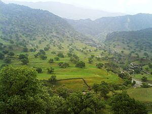
 Tange deel around the Gachsaran city, Early spring
 -
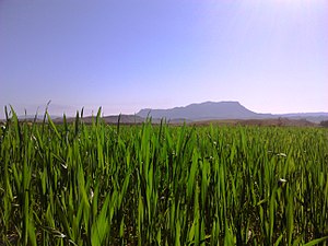
 Barabar around the Gachsaran city, Early spring
 -
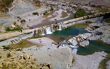 Kayvan fall around Dogonbadan(Gachsaran)
 -

-

-

-

-


References[edit]
- ^ OpenStreetMap contributors (14 August 2023). "Dogonbadan, Gachsaran County" (Map). OpenStreetMap. Retrieved 14 August 2023.
- ^ a b "Census of the Islamic Republic of Iran, 1395 (2016)". AMAR (in Persian). The Statistical Center of Iran. p. 17. Archived from the original (Excel) on 2 November 2021. Retrieved 19 December 2022.
- ^ Dogonbadan can be found at GEOnet Names Server, at this link, by opening the Advanced Search box, entering "-3061393" in the "Unique Feature Id" form, and clicking on "Search Database".
- ^ Habibi, Hassan (21 June 1369). "Approval of the organization and chain of citizenship of the units of the national divisions of Kohgiluyeh and Boyer-Ahmad province, centered in the city of Yasuj". Lamtakam (in Persian). Ministry of Interior, Defense Political Commission of the Government Council. Archived from the original on 24 January 2024. Retrieved 24 January 2024.
- ^ "Census of the Islamic Republic of Iran, 1385 (2006)". AMAR (in Persian). The Statistical Center of Iran. p. 17. Archived from the original (Excel) on 20 September 2011. Retrieved 25 September 2022.
- ^ "Census of the Islamic Republic of Iran, 1390 (2011)". Syracuse University (in Persian). The Statistical Center of Iran. p. 17. Archived from the original (Excel) on 19 January 2023. Retrieved 19 December 2022.
- ^ "Extraction of Crude Petroleum in Iran-Overview". mbendi.com. 2010. Retrieved 2013-06-01.
- ^ "World Meteorological Organization Climate Normals for 1991-2020 — Dogonbadan". National Oceanic and Atmospheric Administration. Retrieved 1 January 2024.
External links[edit]
- Gachsaran cultural site Archived 2019-09-23 at the Wayback Machine
- Gachsaran Daily News Website
| Capital |  | ||||||||||||||||||
|---|---|---|---|---|---|---|---|---|---|---|---|---|---|---|---|---|---|---|---|
| Counties and cities |
| ||||||||||||||||||
| Sights |
| ||||||||||||||||||
| populated places | |||||||||||||||||||
This Gachsaran County location article is a stub. You can help Wikipedia by expanding it. |