
Dorrance, Kansas
Dorrance, Kansas | |
|---|---|
 Location within Russell County and Kansas | |
 | |
| Coordinates: 38°50′49″N 98°35′18″W / 38.84694°N 98.58833°W[1] | |
| Country | United States |
| State | Kansas |
| County | Russell |
| Founded | 1860s |
| Platted | 1880 |
| Incorporated | 1910 |
| Named for | Oliver Dorrance |
| Area | |
| • Total | 0.34 sq mi (0.88 km2) |
| • Land | 0.34 sq mi (0.88 km2) |
| • Water | 0.00 sq mi (0.00 km2) |
| Elevation | 1,732 ft (528 m) |
| Population | |
| • Total | 146 |
| • Density | 430/sq mi (170/km2) |
| Time zone | UTC-6 (CST) |
| • Summer (DST) | UTC-5 (CDT) |
| ZIP code | 67634 |
| Area code | 785 |
| FIPS code | 20-18325 |
| GNIS ID | 475332 [1] |
Dorrance is a city in Russell County, Kansas, United States.[1] As of the 2020 census, the population of the city was 146.[3]
History[edit]
The Kansas Pacific Railway reached the site of Dorrance in June 1867. German, English, and Irish settlers followed shortly thereafter, forming a small community by 1870.[4] In early 1872, they were joined by a colony of settlers from Pennsylvania.[5] A prairie fire destroyed much of the community's business district in March 1879.[4] The town of Dorrance was formally laid out in 1880, named for Oliver Dorrance, the railroad superintendent.[6][7] The first post office opened in July 1883.[8] Dorrance was incorporated in April 1910 and became a center of goods and services for eastern Russell County.[9][10]
Geography[edit]
Dorrance is located in north-central Kansas 102 miles (164 km) northwest of Wichita and 214 miles (344 km) west of Kansas City.[11] Located 1⁄2 mile (0.80 km) south of Interstate 70, it is roughly 15 miles (24 km) east-southeast of Russell, the county seat.[12]
Dorrance lies in the Smoky Hills region of the Great Plains approximately 3 miles (4.8 km) north of the Smoky Hill River and 6 miles (9.7 km) south of Wilson Lake.[12]
According to the United States Census Bureau, the city has a total area of 0.34 square miles (0.88 km2), all of it land.[13]
Climate[edit]
The climate in this area is characterized by hot, humid summers and generally mild to cool winters. According to the Köppen Climate Classification system, Dorrance has a humid subtropical climate, abbreviated "Cfa" on climate maps.[14]
Demographics[edit]
| Census | Pop. | Note | %± |
|---|---|---|---|
| 1910 | 281 | — | |
| 1920 | 299 | 6.4% | |
| 1930 | 325 | 8.7% | |
| 1940 | 414 | 27.4% | |
| 1950 | 385 | −7.0% | |
| 1960 | 331 | −14.0% | |
| 1970 | 234 | −29.3% | |
| 1980 | 220 | −6.0% | |
| 1990 | 195 | −11.4% | |
| 2000 | 205 | 5.1% | |
| 2010 | 185 | −9.8% | |
| 2020 | 146 | −21.1% | |
| U.S. Decennial Census | |||
2020 census[edit]
The 2020 United States census counted 146 people, 75 households, and 42 families in Dorrance.[15][16] The population density was 430.7 per square mile (166.3/km2). There were 97 housing units at an average density of 286.1 per square mile (110.5/km2).[16][17] The racial makeup was 93.15% (136) white or European American (93.15% non-Hispanic white), 0.0% (0) black or African-American, 0.0% (0) Native American or Alaska Native, 1.37% (2) Asian, 0.0% (0) Pacific Islander or Native Hawaiian, 0.68% (1) from other races, and 4.79% (7) from two or more races.[18] Hispanic or Latino of any race was 0.68% (1) of the population.[19]
Of the 75 households, 16.0% had children under the age of 18; 49.3% were married couples living together; 22.7% had a female householder with no spouse or partner present. 44.0% of households consisted of individuals and 16.0% had someone living alone who was 65 years of age or older.[16] The average household size was 2.6 and the average family size was 3.3.[20] The percent of those with a bachelor’s degree or higher was estimated to be 17.8% of the population.[21]
11.0% of the population was under the age of 18, 6.2% from 18 to 24, 21.9% from 25 to 44, 32.9% from 45 to 64, and 28.1% who were 65 years of age or older. The median age was 55.5 years. For every 100 females, there were 84.8 males.[16] For every 100 females ages 18 and older, there were 88.4 males.[16]
The 2016-2020 5-year American Community Survey estimates show that the median household income was $55,000 (with a margin of error of +/- $33,361) and the median family income was $69,444 (+/- $13,544).[22] Females had a median income of $16,641 (+/- $4,228) for females.[23] Approximately, 5.4% of families and 6.2% of the population were below the poverty line, including 12.0% of those under the age of 18 and 0.0% of those ages 65 or over.[24][25]
2010 census[edit]
As of the 2010 census, there were 185 people, 85 households, and 51 families residing in the city. The population density was 616.7 inhabitants per square mile (238.1/km2). There were 113 housing units at an average density of 376.7 per square mile (145.4/km2). The racial makeup of the city was 96.8% White, 2.7% American Indian, and 0.5% Asian. Hispanics and Latinos of any race were 0.5% of the population.[26]
There were 85 households, of which 25.9% had children under the age of 18 living with them, 51.8% were married couples living together, 2.4% had a male householder with no wife present, 5.9% had a female householder with no husband present, and 40.0% were non-families. 36.5% of all households were made up of individuals, and 14.1% had someone living alone who was 65 years of age or older. The average household size was 2.18, and the average family size was 2.84.[26]
In the city, the population was spread out, with 21.6% under the age of 18, 4.5% from 18 to 24, 22.6% from 25 to 44, 28.6% from 45 to 64, and 22.7% who were 65 years of age or older. The median age was 46.5 years. For every 100 females, there were 98.9 males. For every 100 females age 18 and over, there were 90.8 males age 18 and over.[26]
The median income for a household in the city was $36,250, and the median income for a family was $36,000. Males had a median income of $43,438 versus $37,708 for females. The per capita income for the city was $18,126. 8.3% of families and 20.6% of the population were below the poverty line, including 36.8% of those under the age 18 and 0.0% of those age 65 or over.[26]
2000 census[edit]
As of the census[27] of 2000, there were 205 people, 94 households, and 56 families residing in the city. The population density was 611.1 inhabitants per square mile (235.9/km2). There were 118 housing units at an average density of 351.8 per square mile (135.8/km2). The racial makeup of the city was 99.51% White and 0.49% Asian. Hispanic or Latino of any race were 0.49% of the population.
There were 94 households, out of which 22.3% had children under the age of 18 living with them, 50.0% were married couples living together, 7.4% had a female householder with no husband present, and 39.4% were non-families. 35.1% of all households were made up of individuals, and 20.2% had someone living alone who was 65 years of age or older. The average household size was 2.18 and the average family size was 2.86.
In the city the population was spread out, with 21.0% under the age of 18, 6.3% from 18 to 24, 24.4% from 25 to 44, 29.3% from 45 to 64, and 19.0% who were 65 years of age or older. The median age was 44 years. For every 100 females, there were 89.8 males. For every 100 females age 18 and over, there were 84.1 males.
Economy[edit]
As of 2012, 64.8% of the population over the age of 16 was in the labor force. 0.0% was in the armed forces, and 64.8% was in the civilian labor force with 55.7% being employed and 9.0% unemployed. The composition, by occupation, of the employed civilian labor force was: 35.3% in management, business, science, and arts; 22.1% in sales and office occupations; 16.2% in service occupations; 13.2% in natural resources, construction, and maintenance; and 13.2% in production, transportation, and material moving. The three industries employing the largest percentages of the working civilian labor force were: agriculture, forestry, fishing and hunting, and mining (27.9%); educational services, and health care and social assistance (26.5%); and manufacturing (14.7%).[26]
The cost of living in Dorrance is relatively low; compared to a U.S. average of 100, the cost of living index for the community is 79.2.[28] As of 2012, the median home value in the city was $51,300, and the median selected monthly owner cost was $656 for housing units with a mortgage and $304 for those without.[26]
Government[edit]
Dorrance is a city of the third class with a mayor-council form of government. The city council consists of five members, and it meets on the second Saturday of each month.[29]
Dorrance lies within Kansas's 1st U.S. Congressional District. For the purposes of representation in the Kansas Legislature, the city is located in the 36th district of the Kansas Senate and the 109th district of the Kansas House of Representatives.[29]
Education[edit]
The community is served by Central Plains USD 112 public school district.[30] Students attend schools in Wilson.
Dorrance schools were closed through school unification. The Dorrance Cardinals[31] won the Kansas State High School boys class BB basketball championship in 1956.[32]
Infrastructure[edit]
Transportation[edit]
Interstate 70 and U.S. Route 40 run concurrently east–west less than a mile north of the city. The old alignment of U.S. 40 runs southeast–northwest through Dorrance, intersecting 200th Boulevard, a paved county road formerly designated K-231, which runs north–south along the city's eastern edge.[12][33]
Union Pacific Railroad operates a freight rail line, its Kansas Pacific (KP) line, through Dorrance. The line runs southeast–northwest through the community, parallel to the old alignment of U.S. 40.[34]
Utilities[edit]
Western Electric provides electricity to local residents. H & B Communications provides landline telephone service and offers cable television and internet access.[35] Most residents use natural gas for heating fuel; service is provided by Midwest Energy, Inc.[28][35]
Media[edit]
Dorrance is in the Wichita-Hutchinson, Kansas television market.[36]
Culture[edit]
Points of interest[edit]
The Dorrance Historical Society Museum, located downtown, exhibits artifacts from the community's history.[4][37]
In popular culture and the arts[edit]
Dorrance was among the filming locations for the 1973 film Paper Moon.[38]
Toss Back, the company which invented and first produced the "Snap Back" rim used in NBA basketball, was located in Dorrance.[39]
References[edit]
- ^ a b c d "Dorrance, Kansas", Geographic Names Information System, United States Geological Survey, United States Department of the Interior
- ^ "2019 U.S. Gazetteer Files". United States Census Bureau. Retrieved July 24, 2020.
- ^ a b "Profile of Dorrance, Kansas in 2020". United States Census Bureau. Archived from the original on March 21, 2022. Retrieved March 21, 2022.
- ^ a b c "Area Attractions". Russell Area Chamber of Commerce. Archived from the original on July 27, 2011. Retrieved August 28, 2011.
- ^ Cutler, William G. (1883). "Russell County, Part 2". History of the State of Kansas. Chicago: A. T. Andreas. Archived from the original on July 8, 2003. Retrieved August 28, 2011.
- ^ "Homesteading in Russell County - Dorrance". Kansas Heritage Project. Fort Hays State University. Archived from the original on September 27, 2011. Retrieved August 28, 2011.
- ^ The Biographical Directory of the Railway Officials of America for 1887. Chicago: The Railway Age Publishing Co. 1887. p. 89. Retrieved August 28, 2011.
- ^ "Kansas Post Offices, 1828-1961". Kansas Historical Society. Archived from the original on October 9, 2013. Retrieved June 22, 2014.
- ^ "Dorrance State Bank - Dorrance, Kansas" (PDF). Register of Historic Kansas Places Registration Form. Kansas Historical Society. Retrieved August 28, 2011.
- ^ Blackmar, Frank Wilson (1912). Kansas: A Cyclopedia of State History, Embracing Events, Institutions, Industries, Counties, Cities, Towns, Prominent Persons, Etc. Standard Publishing Company. pp. 534.
- ^ "City Distance Tool". Geobytes. Archived from the original on October 5, 2010. Retrieved October 23, 2010.
- ^ a b c "General Highway Map - Russell County, Kansas" (PDF). Kansas Department of Transportation. October 1, 2010. Retrieved December 12, 2010.
- ^ "US Gazetteer files 2010". United States Census Bureau. Archived from the original on July 2, 2012. Retrieved July 6, 2012.
- ^ Climate Summary for Dorrance, Kansas
- ^ "US Census Bureau, Table P16: HOUSEHOLD TYPE". data.census.gov. Retrieved January 3, 2024.
- ^ a b c d e "US Census Bureau, Table DP1: PROFILE OF GENERAL POPULATION AND HOUSING CHARACTERISTICS". data.census.gov. Retrieved January 3, 2024.
- ^ Bureau, US Census. "Gazetteer Files". Census.gov. Retrieved December 30, 2023.
- ^ "US Census Bureau, Table P1: RACE". data.census.gov. Retrieved January 3, 2024.
- ^ "US Census Bureau, Table P2: HISPANIC OR LATINO, AND NOT HISPANIC OR LATINO BY RACE". data.census.gov. Retrieved January 3, 2024.
- ^ "US Census Bureau, Table S1101: HOUSEHOLDS AND FAMILIES". data.census.gov. Retrieved January 3, 2024.
- ^ "US Census Bureau, Table S1501: EDUCATIONAL ATTAINMENT". data.census.gov. Retrieved January 3, 2024.
- ^ "US Census Bureau, Table S1903: MEDIAN INCOME IN THE PAST 12 MONTHS (IN 2020 INFLATION-ADJUSTED DOLLARS)". data.census.gov. Retrieved January 3, 2024.
- ^ "US Census Bureau, Table S2001: EARNINGS IN THE PAST 12 MONTHS (IN 2020 INFLATION-ADJUSTED DOLLARS)". data.census.gov. Retrieved January 3, 2024.
- ^ "US Census Bureau, Table S1701: POVERTY STATUS IN THE PAST 12 MONTHS". data.census.gov. Retrieved January 3, 2024.
- ^ "US Census Bureau, Table S1702: POVERTY STATUS IN THE PAST 12 MONTHS OF FAMILIES". data.census.gov. Retrieved January 3, 2024.
- ^ a b c d e f "U.S. Census website". United States Census Bureau. Retrieved September 10, 2014.
- ^ "U.S. Census website". United States Census Bureau. Retrieved January 31, 2008.
- ^ a b "Dorrance, Kansas". City-Data.com. Retrieved September 10, 2014.
- ^ a b "Dorrance". Directory of Kansas Public Officials. The League of Kansas Municipalities. Archived from the original on December 13, 2011. Retrieved August 28, 2011.
- ^ "Central Plains USD 112". USD 112. Retrieved January 7, 2017.
- ^ "Dorrance Honors Its State Champs", The Salina Journal, 21 March 1956, p.14.
- ^ "Basketball". KSHSAA. Archived from the original on January 2, 2017. Retrieved January 3, 2017.
- ^ "Official 1960-61 Kansas Highway Map" (PDF). Kansas Department of Transportation. Retrieved December 12, 2010.
- ^ "UPRR Common Line Names" (PDF). Union Pacific Railroad. Retrieved October 23, 2010.
- ^ a b "Utilities". Russell County, Kansas Economic Development & CVB. Archived from the original on January 16, 2015. Retrieved September 10, 2014.
- ^ "Kansas". TV Market Maps. EchoStar Knowledge Base. Archived from the original on July 26, 2011. Retrieved September 10, 2014.
- ^ "Russell County". Blue Skyways. State Library of Kansas. Archived from the original on August 5, 2011. Retrieved August 28, 2011.
- ^ "Paper Moon". Moviediva. November 2010. Retrieved March 6, 2011.
- ^ Bickel, Amy (April 5, 2008). "Still in the game". The Hutchinson News. Retrieved March 6, 2011.
Further reading[edit]
External links[edit]
- Dorrance - Directory of Public Officials
- Historic Images of Dorrance, Wichita State University Library
- Dorrance city map, KDOT
Municipalities and communities of Russell County, Kansas, United States | ||
|---|---|---|
| Cities | 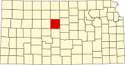 | |
| Unincorporated communities | ||
| Ghost towns | ||
| Townships | ||
| Footnotes | ‡This community also has portions in an adjacent county or counties. | |