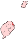
Água Grande District
Água Grande | |
|---|---|
District | |
 Location within São Tomé and Príncipe | |
| Coordinates: 0°20′N 6°44′E / 0.333°N 6.733°E | |
| Country | São Tomé and Príncipe |
| Island | São Tomé |
| Seat | São Tomé |
| Area | |
| • Total | 16.5 km2 (6.4 sq mi) |
| Population (2018) | |
| • Total | 77,700 |
| • Density | 4,700/km2 (12,000/sq mi) |
| Time zone | UTC+0 (UTC) |
Água Grande is a district of São Tomé and Príncipe, on São Tomé Island. Its capital, São Tomé, is also the national capital of the equatorial Atlantic island nation of São Tomé and Príncipe. Covering only 16.5 km2 (6 sq mi), it is the smallest of the nation's seven districts in terms of area,[1] but the largest in population with 69,454 residents in 2012 rising to an estimated 77,700 in 2018.[2] It is divided into the two statistical subdistricts São Tomé and Pantufo.[3][2]: 15
Population[edit]
| Year | Population |
|---|---|
| 1940[4] | 8,407
|
| 1950[4] | 7,820
|
| 1960[4] | 9,575
|
| 1970[4] | 19,630
|
| 1981[4] | 32,375
|
| 1991[4] | 42,331
|
| 2001[4][2] | 51,886
|
| 2012[4][2] | 69,454
|
Settlements[edit]
The main settlement is the town São Tomé. Other settlements are:
Politics[edit]
Água Grande currently has 13 seats in the National Assembly.[5]
Persons[edit]
- Marcos Barbeiro, footballer
- Guadalupe de Ceita, medic and a politician
- Manuel Pinto da Costa, politician, President of São Tomé and Príncipe from 2011 to 2016
- Adimar Neves, footballer currently living in Europe
- Lecabela Quaresma, athlete
International relations[edit]
Água Grande District is twinned with:
References[edit]
- ^ Sao Tome and Principe, citypopulation.de
- ^ a b c d Projecção a nível distrital 2012 - 2020, Instituto Nacional de Estatística
- ^ Statistical divisions of São Tomé and Príncipe, Instituto Nacional de Estatística
- ^ a b c d e f g h Evolução da População Recenseada, 1940 a 2012, Instituto Nacional de Estatística
- ^ Elections in São Tomé and Principe, African Elections Database.
- ^ "Lisboa - Geminações de Cidades e Vilas" [Lisbon - Twinning of Cities and Towns]. Associação Nacional de Municípios Portugueses [National Association of Portuguese Municipalities] (in Portuguese). Retrieved 2013-08-23.

