
Laurel, Virginia
Laurel, Virginia | |
|---|---|
 A building from the Laurel Industrial School Historic District | |
 Location of Laurel, Virginia | |
| Coordinates: 37°38′2″N 77°30′24″W / 37.63389°N 77.50667°W | |
| Country | United States |
| State | Virginia |
| County | Henrico |
| Area | |
| • Total | 5.4 sq mi (14.1 km2) |
| • Land | 5.4 sq mi (14.0 km2) |
| • Water | 0.0 sq mi (0.1 km2) |
| Elevation | 243 ft (74 m) |
| Population | |
| • Total | 17,769 |
| • Density | 3,300/sq mi (1,300/km2) |
| Time zone | UTC−5 (Eastern (EST)) |
| • Summer (DST) | UTC−4 (EDT) |
| ZIP Codes | 23075, 23228, 23229, 23231, 23233, 23238, 23242, 23255, 23288, 23294 |
| FIPS code | 51-44280[2] |
| GNIS feature ID | 1469155[3] |
Laurel is a census-designated place (CDP) in western Henrico County, Virginia, United States. The population was 17,769 at the 2020 United States Census.[1] It is the county seat of Henrico County.
It is the location of the Laurel Skate Park. The bowl was recently filled in with smooth concrete and the vertical ramp removed to make way for safer amenities.[4]
Laurel is the location of the Laurel Industrial School Historic District.
History[edit]
Laurel's previous names include Hungary, Hungary Station, Jenningsville, and School.[5] In the 19th century, Laurel was a stop on the Richmond, Fredericksburg and Potomac (RF&P) Railroad. It was a spur line that connected the coalfields in western Henrico with the rail network. During the Civil War, the station was burned. Union Army Colonel Ulric Dahlgren's body was secretly buried there in March 1864; the body was later re-interred to Philadelphia.[6] The RF&P railroad is succeeded by CSX Transportation, which still operates on the same rights-of-way.
The A.A. Harvey General Store was built c. 1910 to serve the community. Over the years, the building has undergone several transformations. It went from general store to housing. It then became the Crystal Ice Co. and the Laurel Post Office, where Lillian Merkle was Postmaster[when?]. The Post Office was one of only a few in the United States that was privately owned.[7] The building was completely restored in 1991 to its present use as the Laurel Gallery. Robert Bluford, the preservationist, made efforts to ensure that the restored building stayed true to its original style.[6]
Geography[edit]
Laurel is located at 37°38′2″N 77°30′24″W / 37.63389°N 77.50667°W (37.634012, −77.506661).[8]
According to the United States Census Bureau, the CDP has a total area of 5.4 square miles (14.1 km2), of which 5.4 square miles (14.0 km2) is land and 0.04 square miles (0.1 km2), or 0.71%, is water.[9]
Demographics[edit]
| Census | Pop. | Note | %± |
|---|---|---|---|
| 1980 | 10,569 | — | |
| 1990 | 13,011 | 23.1% | |
| 2000 | 14,875 | 14.3% | |
| 2010 | 16,713 | 12.4% | |
| 2020 | 17,769 | 6.3% | |
| U.S. Decennial Census[10] | |||
As of the census[2] of 2000, there were 14,875 people, 6,288 households, and 3,634 families residing in the CDP. The population density was 2,713.6 inhabitants per square mile (1,047.7/km2). There were 6,522 housing units at an average density of 1,189.8 sq mi (3,082 km2). The racial makeup of the CDP was 64.98% White, 24.30% African American, 0.33% Native American, 6.16% Asian, 0.05% Pacific Islander, 2.08% from other races, and 2.08% from two or more races. Hispanic or Latino of any race were 4.15% of the population.
There were 6,288 households, out of which 27.2% had children under the age of 18 living with them, 42.0% were married couples living together, 12.0% had a female householder with no husband present, and 42.2% were non-families. 32.8% of all households were made up of individuals, and 7.1% had someone living alone who was 65 years of age or older. The average household size was 2.24 and the average family size was 2.87.
In the CDP, the population was spread out, with 20.2% under the age of 18, 10.6% from 18 to 24, 38.5% from 25 to 44, 19.6% from 45 to 64, and 11.0% who were 65 years of age or older. The median age was 34 years. For every 100 females, there were 93.4 males. For every 100 females age 18 and over, there were 91.6 males.
The median income for a household in the CDP was $42,128, and the median income for a family was $52,579. Males had a median income of $31,495 versus $30,158 for females. The per capita income for the CDP was $21,893. About 3.8% of families and 5.4% of the population were below the poverty line, including 4.7% of those under age 18 and 2.0% of those age 65 or over.
References[edit]
- ^ a b "QuickFacts: Laurel CDP, Virginia". United States Census Bureau. Retrieved March 20, 2024.
- ^ a b "U.S. Census website". United States Census Bureau. Retrieved January 31, 2008.
- ^ "US Board on Geographic Names". United States Geological Survey. October 25, 2007. Retrieved January 31, 2008.
- ^ "Laurel Recreation Area & Skate Park - Henrico County, Virginia". henrico.us. Retrieved January 3, 2022.
- ^ An Opportunity to Reform: The Laurel Industrial School & History of Juvenile Corrections in Henrico, retrieved January 3, 2022
- ^ a b "History of Laurel". laurelgalleryrva.com. Retrieved January 3, 2022.
- ^ "National Register of Historic Places Inventory-Nomination Form: Lauren Industrial School Historic District" (PDF). June 12, 1987.
{{cite journal}}: Cite journal requires|journal=(help) - ^ "US Gazetteer files: 2010, 2000, and 1990". United States Census Bureau. February 12, 2011. Retrieved April 23, 2011.
- ^ "Geographic Identifiers: 2010 Demographic Profile Data (G001): Laurel CDP, Virginia". United States Census Bureau. Retrieved August 6, 2012.
- ^ "Census of Population and Housing". Census.gov. Retrieved June 4, 2015.
Municipalities and communities of Henrico County, Virginia, United States | ||
|---|---|---|
| CDPs | 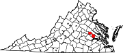 | |
| Unincorporated communities | ||