
Springdale, Pennsylvania
Springdale, Pennsylvania | |
|---|---|
 | |
| Nickname: Power City | |
 Location in Allegheny County and the U.S. state of Pennsylvania. | |
 | |
 Springdale  Springdale | |
| Coordinates: 40°32′29″N 79°46′56″W / 40.54139°N 79.78222°W | |
| Country | United States |
| State | Pennsylvania |
| County | Allegheny |
| First settled | 1730 |
| Incorporated | Oct 17, 1906 |
| Government | |
| • Mayor | Joel Anderson [1] |
| Area | |
| • Total | 1.09 sq mi (2.83 km2) |
| • Land | 0.93 sq mi (2.42 km2) |
| • Water | 0.16 sq mi (0.42 km2) |
| Elevation | 814 ft (248 m) |
| Population | |
| • Total | 3,400 |
| • Density | 3,640.26/sq mi (1,406.07/km2) |
| Time zone | UTC-5 (Eastern (EST)) |
| • Summer (DST) | UTC-4 (EDT) |
| ZIP code | 15144 |
| Area code | 724 |
| School district | Allegheny Valley |
| Website | www |
Springdale is a borough in northeastern Allegheny County, Pennsylvania, United States, 18 miles (29 km) northeast of Pittsburgh along the Allegheny River. The population was 3,400 at the 2020 census.[4] The borough became official in 1906, after breaking away from the township.
History[edit]
Springdale Borough was incorporated in 1906, when it broke away from the larger Springdale Township, and was named after the natural springs and the surrounding small valley, or the "dale." The area was originally inhabited by Native American tribes, but soon overtaken by Europeans. The town became a bustling railroad town and a hub for the coal industry in the late 1800s and the early 1900s. Springdale originally got its name in the year 1820 by either Hannah Keene or her daughter, Frances. Before this, the town is believed to have been known as "Deertown."[5] Today, Springdale is a quiet residential community with a small downtown area and many small businesses.
The first European settlers arrived in the area in the early 1800s. Among these settlers were familiar names such as Pillow, Coe, Remaley, Henderson, Mellon, Brackenridge, Denny, Hanna, Keene, Shoop, and Moyer. Many streets in Springdale today are named after these families.
Geography[edit]
Springdale is located at 40°32′27″N 79°47′2″W / 40.54083°N 79.78389°W (40.5409, -79.7839).[6]
According to the U.S. Census Bureau, the borough has a total area of 1.1 square miles (2.8 km2), of which 0.9 square miles (2.3 km2), or 82.14%, is land, and 0.2 square miles (0.52 km2), or 18.57%, is water.
Streams[edit]
The Riddle Run joins the Allegheny River at Springdale.[7]
The Tawney Run flows between Springdale and Cheswick.
Surrounding and adjacent communities[edit]
Springdale has two land borders, including Springdale Township to the north and Cheswick to the west. Adjacent across the Allegheny River to the east and south is Plum.
Demographics[edit]
| Census | Pop. | Note | %± |
|---|---|---|---|
| 1880 | 456 | — | |
| 1910 | 1,999 | — | |
| 1920 | 2,929 | 46.5% | |
| 1930 | 4,781 | 63.2% | |
| 1940 | 4,989 | 4.4% | |
| 1950 | 4,939 | −1.0% | |
| 1960 | 5,602 | 13.4% | |
| 1970 | 5,202 | −7.1% | |
| 1980 | 4,418 | −15.1% | |
| 1990 | 3,992 | −9.6% | |
| 2000 | 3,828 | −4.1% | |
| 2010 | 3,405 | −11.1% | |
| 2020 | 3,400 | −0.1% | |
| U.S. Decennial Census[8] | |||
As of the census[9] of 2000, there were 3,828 people, 1,685 households, and 1,034 families residing in the borough. The population density was 4,104.2 inhabitants per square mile (1,584.6/km2). There were 1,802 housing units at an average density of 1,932.0 per square mile (745.9/km2). The racial makeup of the borough was 99.03% White, 0.29% African American, 0.08% Native American, 0.13% Asian, 0.18% from other races, and 0.29% from two or more races. Hispanic or Latino of any race were 0.21% of the population.
There were 1,685 households, out of which 25.8% had children under the age of 18 living with them, 46.2% were married couples living together, 11.9% had a female householder with no husband present, and 38.6% were non-families. 34.4% of all households were made up of individuals, and 16.5% had someone living alone who was 65 years of age or older. The average household size was 2.26 and the average family size was 2.93.
In the borough the population was spread out, with 21.9% under the age of 18, 6.0% from 18 to 24, 29.5% from 25 to 44, 22.2% from 45 to 64, and 20.5% who were 65 years of age or older. The median age was 41 years. For every 100 females, there were 89.0 males. For every 100 females age 18 and over, there were 86.7 males.
The median income for a household in the borough was $35,440, and the median income for a family was $43,476. Males had a median income of $36,711 versus $25,920 for females. The per capita income for the borough was $19,798. About 3.5% of families and 7.8% of the population were below the poverty line, including 10.2% of those under age 18 and 8.8% of those age 65 or over.
Government and politics[edit]
| Year | Republican | Democratic | Third parties |
|---|---|---|---|
| 2020 | 53% 1,002 | 45% 843 | 1% 23 |
| 2016 | 55% 834 | 44% 660 | 1% 22 |
| 2012 | 51% 767 | 48% 716 | 1% 24 |
Museums and other points of interest[edit]
The Springdale Free Public Library serves the borough.[13]
The Rachel Carson Homestead is located in Springdale.
Springdale is also notable for its proximity to a variety of industrial locations, including a local PPG plant (which celebrated its 75th anniversary in June 2022), and the formerly active Cheswick Generating Station, a coal-fired electric power plant known for its two large smokestacks which dominate the skyline for miles.
Education[edit]
The borough is within the Allegheny Valley School District, and is served by Springdale Jr-Sr High School. The former Colfax Upper Elementary School sits several blocks below the high school.
Gallery[edit]
-
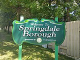 Springdale Welcome sign
 -
 Rachel Carson Homestead in May 2007
 -
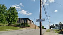 Uphill view of Springdale Jr-Sr High School


Notable people[edit]
- Rachel Carson, a marine biologist who authored Silent Spring.
- Conrad Susa, renowned composer of opera and Juilliard alumnus.
- Tony Janiro, an American middleweight boxer.
See also[edit]
- List of crossings of the Allegheny River (coal mine tunnels)
- Logans Ferry Mine Tunnel
References[edit]
- ^ "Administration".
- ^ "ArcGIS REST Services Directory". United States Census Bureau. Retrieved October 16, 2022.
- ^ "Census Population API". United States Census Bureau. Retrieved October 12, 2022.
- ^ "Explore Census Data".
- ^ Ross, Lynn M. (2006). History of the Borough of Springdale, Pennsylvania, 1906-2006 (Centennial ed.). Lynn M. Ross.
- ^ "GPS coordinates of Springdale, Pennsylvania, United States, DMS, UTM, GeoHash - CountryCoordinate.com". www.countrycoordinate.com. Retrieved September 27, 2023.
- ^ "Riddle Run". Geographic Names Information System. August 2, 1979. Retrieved December 2, 2009.
- ^ "Census of Population and Housing". Census.gov. Retrieved June 4, 2016.
- ^ "U.S. Census website". United States Census Bureau. Retrieved January 31, 2008.
- ^ EL. "2012 Allegheny County election". Pittsburgh Tribune-Review. Retrieved October 15, 2017.
- ^ EL. "2016 Pennsylvania general election results". Pittsburgh Post-Gazette. Retrieved October 15, 2017.
- ^ "Election Night Reporting".
- ^ "Springdale Free Public Library". Retrieved August 11, 2010.
External links[edit]

| Geographic | |
|---|---|
| Other | |