
Dilley, Texas
Dilley, Texas | |
|---|---|
.jpg) Do Dilley, Texas | |
| Motto: "A slice of the good life" | |
 Location of Dilley, Texas | |
 | |
| Coordinates: 28°40′15″N 99°10′11″W / 28.67083°N 99.16972°W | |
| Country | United States |
| State | Texas |
| County | Frio |
| Government | |
| • Type | Mayor-council government |
| • Mayor | Mary Ann Obregon |
| Area | |
| • Total | 2.33 sq mi (6.04 km2) |
| • Land | 2.33 sq mi (6.04 km2) |
| • Water | 0.00 sq mi (0.00 km2) |
| Elevation | 561 ft (171 m) |
| Population (2010) | |
| • Total | 3,894 |
| • Estimate (2019)[2] | 4,489 |
| • Density | 1,925.78/sq mi (743.67/km2) |
| Time zone | UTC-6 (Central (CST)) |
| • Summer (DST) | UTC-5 (CDT) |
| ZIP code | 78017 |
| Area code | 830 |
| FIPS code | 48-20428[3] |
| GNIS feature ID | 1356027[4] |
| Website | www |
Dilley is a town in Frio County, Texas, United States. The population was 3,894 at the 2010 census.[5] It is located off Interstate 35, south of the county seat in Pearsall.
Geography[edit]
Dilley is located in southern Frio County at 28°40′15″N 99°10′11″W / 28.67083°N 99.16972°W (28.670824, –99.169820).[6] Interstate 35 bypasses the city on the west, with access from Exits 82 through 86. I-35 leads northeastward 71 miles (114 km) to San Antonio and southward 83 miles (134 km) to Laredo. Pearsall, the county seat, is 16 miles (26 km) to the north. Texas State Highway 85 passes through the center of town as Leona Street, leading northeast 49 miles (79 km) to Pleasanton and west 58 miles (93 km) to Carrizo Springs.
According to the United States Census Bureau, Dilley has a total area of 2.4 square miles (6.1 km2), all land.[5]
Demographics[edit]
| Census | Pop. | Note | %± |
|---|---|---|---|
| 1930 | 929 | — | |
| 1940 | 1,244 | 33.9% | |
| 1950 | 1,809 | 45.4% | |
| 1960 | 2,118 | 17.1% | |
| 1970 | 2,362 | 11.5% | |
| 1980 | 2,579 | 9.2% | |
| 1990 | 2,632 | 2.1% | |
| 2000 | 3,674 | 39.6% | |
| 2010 | 3,894 | 6.0% | |
| 2019 (est.) | 4,489 | [2] | 15.3% |
| U.S. Decennial Census[7] | |||
2020 census[edit]
| Race | Number | Percentage |
|---|---|---|
| White (NH) | 383 | 11.7% |
| Black or African American (NH) | 181 | 5.53% |
| Native American or Alaska Native (NH) | 3 | 0.09% |
| Asian (NH) | 9 | 0.27% |
| Some Other Race (NH) | 18 | 0.55% |
| Mixed/Multi-Racial (NH) | 15 | 0.46% |
| Hispanic or Latino | 2,665 | 81.4% |
| Total | 3,274 |
As of the 2020 United States census, there were 3,274 people, 886 households, and 585 families residing in the city.
2000 census[edit]
As of the census[3] of 2000, there were 3,674 people, 955 households, and 727 families residing in the city. The population density was 1,574.3 inhabitants per square mile (607.8/km2). There were 1,158 housing units at an average density of 496.2 per square mile (191.6/km2). The racial makeup of the city was 66.93% White, 10.40% African American, 0.57% Native American, 0.76% Asian, 18.81% from other races, and 2.53% from two or more races. Hispanic or Latino of any race were 72.24% of the population.
There were 955 households, out of which 42.1% had children under the age of 18 living with them, 49.7% were married couples living together, 20.0% had a female householder with no husband present, and 23.8% were non-families. 21.9% of all households were made up of individuals, and 9.2% had someone living alone who was 65 years of age or older. The average household size was 3.00 and the average family size was 3.47.
In the city, the population was spread out, with 27.9% under the age of 18, 13.0% from 18 to 24, 35.5% from 25 to 44, 14.9% from 45 to 64, and 8.8% who were 65 years of age or older. The median age was 29 years. For every 100 females, there were 145.8 males. For every 100 females age 18 and over, there were 166.9 males.
The median income for a household in the city was $19,540, and the median income for a family was $22,021. Males had a median income of $26,825 versus $13,229 for females. The per capita income for the city was $20,475. About 32.6% of families and 35.8% of the population were below the poverty line, including 42.5% of those under age 18 and 31.3% of those age 65 or over.
Education[edit]
The city is served by the Dilley Independent School District. The Dilley Independent School District has three schools: Dilley Elementary, Mary Harper Middle School, and Dilley High School.
In popular culture[edit]
- A highly fictionalized version of Dilley appears in Messiah.[citation needed]
Gallery[edit]
-
 City Hall in Dilley is in the Avant Building.
 -
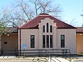
 The Dilley Chamber of Commerce building
 -
 Dilley Feed and Grain operates a grain elevator and silos.
 -
 Dilley State Bank is located just off Interstate 35.
 -
 A small but modern hospital operates in Dilley.
 -
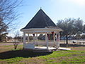 A pavilion in the downtown park in Dilley
 -
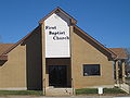 First Baptist Church in Dilley
 -
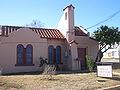
 First United Methodist Church in Dilley with the "Catch the Spirit" emblem
 -
 Tex Best, a large convenience store, operates off Interstate 35 in Dilley.
 -
 Dilley from Interstate 35
 -
 Welcome sign
 -


Climate[edit]
The climate in this area is characterized by hot, humid summers and generally mild to cool winters. According to the Köppen Climate Classification system, Dilley has a humid subtropical climate, abbreviated "Cfa" on climate maps.[10]
See also[edit]
- South Texas Family Residential Center, located in Dilley, the largest immigrant detention center in the United States
References[edit]
- ^ "2019 U.S. Gazetteer Files". United States Census Bureau. Retrieved August 7, 2020.
- ^ a b "Population and Housing Unit Estimates". United States Census Bureau. May 24, 2020. Retrieved May 27, 2020.
- ^ a b "U.S. Census website". United States Census Bureau. Retrieved January 31, 2008.
- ^ "US Board on Geographic Names". United States Geological Survey. October 25, 2007. Retrieved January 31, 2008.
- ^ a b "Geographic Identifiers: 2010 Demographic Profile Data (G001): Dilley town, Texas". U.S. Census Bureau, American Factfinder. Retrieved September 7, 2016.[dead link]
- ^ "US Gazetteer files: 2010, 2000, and 1990". United States Census Bureau. February 12, 2011. Retrieved April 23, 2011.
- ^ "Census of Population and Housing". Census.gov. Retrieved June 4, 2015.
- ^ "Explore Census Data". data.census.gov. Retrieved May 20, 2022.
- ^ "About the Hispanic Population and its Origin". www.census.gov. Retrieved May 18, 2022.
- ^ Climate Summary for Dilley, Texas
External links[edit]
- City of Dilley official website
- Handbook of Texas Online – Dilley
- Dilley Independent School District
Municipalities and communities of Frio County, Texas, United States | ||
|---|---|---|
| Cities |  | |
| CDPs | ||
| Other community | ||
| Ghost town | ||
| International | |
|---|---|
| National | |
| Geographic | |