
May, Oklahoma
May, Oklahoma | |
|---|---|
 Location in Harper County and the state of Oklahoma. | |
| Coordinates: 36°37′00″N 99°44′55″W / 36.61667°N 99.74861°W | |
| Country | United States |
| State | Oklahoma |
| County | Harper |
| Area | |
| • Total | 0.17 sq mi (0.44 km2) |
| • Land | 0.17 sq mi (0.44 km2) |
| • Water | 0.00 sq mi (0.00 km2) |
| Elevation | 2,041 ft (622 m) |
| Population (2020) | |
| • Total | 29 |
| • Density | 169.59/sq mi (65.49/km2) |
| Time zone | UTC-6 (Central (CST)) |
| • Summer (DST) | UTC-5 (CDT) |
| ZIP code | 73851 |
| Area code | 580 |
| FIPS code | 40-47000[3] |
| GNIS feature ID | 2412964[2] |
May is a town in Harper County, Oklahoma, United States. As of the 2020 census, the town’s population was 29.[4]
Geography[edit]
May is located on U.S. Highway 412 at the intersection with State Highway 46, approximately 26 miles northwest of Woodward.[5]
According to the United States Census Bureau, the town has a total area of 0.2 square miles (0.52 km2), all land. May was served by the Northwestern District of the Missouri–Kansas–Texas Railroad until that line's abandonment in January 1973.[6]
Demographics[edit]
| Census | Pop. | Note | %± |
|---|---|---|---|
| 1920 | 324 | — | |
| 1930 | 258 | −20.4% | |
| 1940 | 239 | −7.4% | |
| 1950 | 143 | −40.2% | |
| 1970 | 91 | — | |
| 1990 | 42 | — | |
| 2000 | 33 | −21.4% | |
| 2010 | 39 | 18.2% | |
| 2020 | 29 | −25.6% | |
| U.S. Decennial Census[7] | |||
As of the census[3] of 2000, there were 33 people, 17 households, and 7 families residing in the town. The population density was 183.6 inhabitants per square mile (70.9/km2). There were 27 housing units at an average density of 150.2 per square mile (58.0/km2). The racial makeup of the town was 100.00% White. Hispanic or Latino of any race were 3.03% of the population.
There were 17 households, out of which 17.6% had children under the age of 18 living with them, 41.2% were married couples living together, and 58.8% were non-families. 47.1% of all households were made up of individuals, and 17.6% had someone living alone who was 65 years of age or older. The average household size was 1.94 and the average family size was 3.00.
In the town, the population was spread out, with 18.2% under the age of 18, 6.1% from 18 to 24, 30.3% from 25 to 44, 33.3% from 45 to 64, and 12.1% who were 65 years of age or older. The median age was 41 years. For every 100 females, there were 120.0 males. For every 100 females age 18 and over, there were 145.5 males.
The median income for a household in the town was $45,625, and the median income for a family was $50,313. Males had a median income of $30,833 versus $19,167 for females. The per capita income for the town was $20,319. None of the population and none of the families were below the poverty line.
References[edit]
- ^ "ArcGIS REST Services Directory". United States Census Bureau. Retrieved September 20, 2022.
- ^ a b U.S. Geological Survey Geographic Names Information System: May, Oklahoma
- ^ a b "U.S. Census website". United States Census Bureau. Retrieved January 31, 2008.
- ^ "May (Town), Oklahoma". United States Census Bureau. Retrieved August 6, 2023.
- ^ "May, Oklahoma to Woodward, Oklahoma". Google Maps. Retrieved August 6, 2023.
- ^ Hofsommer, Donovan L. (1976). Katy Northwest: The Story of a Branch Line Railroad. Indiana University Press. ISBN 0253336368.
- ^ "Census of Population and Housing". Census.gov. Retrieved June 4, 2016.
Further reading[edit]
Municipalities and communities of Harper County, Oklahoma, United States | ||
|---|---|---|
| Towns | 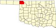 | |
| CDP | ||
| Ghost towns | ||