
Lake and Peninsula Borough, Alaska
Lake and Peninsula Borough | |
|---|---|
Left to right, from top: Wassillie Trefon Dena'ina Fish Cache in Port Alsworth, Alagnak River rapids, shore at Nondalton, the Aleutian Express in Chignik Bay, view of Mount Peulik in Becharof National Wildlife Refuge, view of the Twin Lakes | |
 Seal Logo | |
 Location within the U.S. state of Alaska | |
.svg) Alaska's location within the U.S. | |
| Coordinates: 58°24′N 156°11′W / 58.4°N 156.18°W | |
| Country | |
| State | |
| Incorporated | April 24, 1989[1][2] |
| Named for | Iliamna Lake, Becharof Lake and Alaska Peninsula |
| Seat | King Salmon |
| Largest CDP | Port Alsworth |
| Government | |
| • Mayor | Glen R. Alsworth, Sr. |
| Area | |
| • Total | 32,922 sq mi (85,270 km2) |
| • Land | 23,652 sq mi (61,260 km2) |
| • Water | 9,270 sq mi (24,000 km2) 28.2% |
| Population (2020) | |
| • Total | 1,381 |
| • Density | 0.042/sq mi (0.016/km2) |
| Time zone | UTC−9 (Alaska) |
| • Summer (DST) | UTC−8 (ADT) |
| Congressional district | At-large |
| Website | www |


Lake and Peninsula Borough (Russian: Лейк-энд-Пенинсула, Leyk-end-Peninsula) is a borough in the state of Alaska. As of the 2020 census, the population was 1,476,[3] down from 1,631 in 2010.[4] The borough seat of King Salmon[5] is located in neighboring Bristol Bay Borough, although is not the seat of that borough. The most populous community in the borough is the census-designated place of Port Alsworth. With an average of 0.017 inhabitants per square kilometre (0.044 inhabitants/sq mi), the Lake and Peninsula Borough is the second least densely populated organized county-equivalent in the United States; only the unorganized Yukon-Koyukuk Census Area has a lower density.
Geography[edit]

The borough has an area of 32,922 square miles (85,270 km2), of which 23,652 square miles (61,260 km2) is land and 9,270 square miles (24,000 km2) (28.2%) is water.[6] The borough contains Iliamna Lake, the largest lake in Alaska and third largest within United States borders, and occupies most of the Alaska Peninsula. Its land area is larger than that of San Bernardino County, California, the largest county in the contiguous Lower 48 states.
Adjacent boroughs and census areas[edit]
- Bethel Census Area, Alaska – north
- Kenai Peninsula Borough, Alaska – east
- Kodiak Island Borough, Alaska – southeast
- Aleutians East Borough, Alaska – west
- Bristol Bay Borough, Alaska – west
- Dillingham Census Area, Alaska – west
National protected areas[edit]
- Alagnak Wild River
- Alaska Maritime National Wildlife Refuge (part of the Alaska Peninsula unit)
- Alaska Peninsula National Wildlife Refuge (part)
- Aniakchak National Monument and Preserve
- Becharof National Wildlife Refuge (part)
- Becharof Wilderness (part)
- Katmai National Park and Preserve (part)
- Katmai Wilderness (part)
- Lake Clark National Park and Preserve (part)
- Lake Clark Wilderness (part)
Demographics[edit]
| Census | Pop. | Note | %± |
|---|---|---|---|
| 1990 | 1,668 | — | |
| 2000 | 1,823 | 9.3% | |
| 2010 | 1,631 | −10.5% | |
| 2020 | 1,476 | −9.5% | |
| 2023 (est.) | 1,331 | [7] | −9.8% |
| U.S. Decennial Census[8] 1990–2000[9] 2010–2020[4] | |||
As of the census[10] of 2000, there were 1,823 people, 588 households, and 418 families residing in the borough. The population density was 0.059 people per square mile (0.023 people/km2). There were 1,557 housing units at an average density of 0.05 per square mile (0.019/km2). The racial makeup of the borough was 18.76% White, 0.05% Black or African American, 73.51% Native American, 0.22% Asian, 0.16% Pacific Islander, 0.33% from other races, and 6.97% from two or more races. 1.15% of the population were Hispanic or Latino of any race. About 5.41% reported speaking a Yupik language at home, while 3.87% speak Alutiiq and 1.23% an Athabaskan language.[11]
Some 44.70% of households had children under the age of 18 living with them, 48.50% were married couples living together, 9.70% had a female householder with no husband present, and 28.90% were non-families. About 24.70% of all households were made up of individuals, and 3.90% consisted of a sole occupant 65 years of age or older. The average household size was 3.10 and the average family size was 3.74.
In the borough, the age of the population was spread out, with 37.80% under the age of 18, 8.50% from 18 to 24, 28.00% from 25 to 44, 20.20% from 45 to 64, and 5.40% who were 65 years of age or older. The median age was 29 years. For every 100 females, there were 113.50 males. For every 100 females age 18 and over, there were 124.10 males.
The dominant religion is Orthodox Christianity.
Government[edit]
The Borough is governed by an elected assembly. The Borough's mayor is Glen R. Alsworth, Sr. The deputy mayor is Myra J. Olsen. The other members of the assembly are Randy Alvarez, Scott Anderson, Alvin Pedersen, Michelle Pope-Ravenmoon, and Christina Salmon-Bringhurst.[12]
| Year | Republican | Democratic | Third party | |||
|---|---|---|---|---|---|---|
| No. | % | No. | % | No. | % | |
| 2020 | 234 | 36.34% | 358 | 55.59% | 52 | 8.07% |
| 2016 | 174 | 43.28% | 193 | 48.01% | 35 | 8.71% |
| 2012 | 143 | 39.29% | 212 | 58.24% | 9 | 2.47% |
| 2008 | 299 | 59.56% | 185 | 36.85% | 18 | 3.59% |
| 2004 | 224 | 65.88% | 114 | 33.53% | 2 | 0.59% |
| 2000 | 297 | 57.34% | 196 | 37.84% | 25 | 4.83% |
| 1996 | 235 | 44.76% | 240 | 45.71% | 50 | 9.52% |
| 1992 | 291 | 48.26% | 152 | 25.21% | 160 | 26.53% |
| 1988 | 342 | 67.06% | 162 | 31.76% | 6 | 1.18% |
| 1984 | 446 | 78.94% | 105 | 18.58% | 14 | 2.48% |
| 1980 | 225 | 54.09% | 130 | 31.25% | 61 | 14.66% |
| 1976 | 212 | 58.08% | 131 | 35.89% | 22 | 6.03% |
| 1972 | 180 | 48.91% | 170 | 46.20% | 18 | 4.89% |
| 1968 | 195 | 44.72% | 189 | 43.35% | 52 | 11.93% |
| 1964 | 82 | 18.72% | 356 | 81.28% | 0 | 0.00% |
| 1960 | 121 | 36.45% | 211 | 63.55% | 0 | 0.00% |
Communities[edit]
Cities[edit]
Census-designated places[edit]
Ghost town[edit]
See also[edit]
References[edit]
- ^ "Substantial Changes to Counties and County Equivalent Entities: 1970–Present". United States Census Bureau, Geography Division. May 24, 2002. Archived from the original on May 6, 2009. Retrieved May 4, 2012.
- ^ 1996 Alaska Municipal Officials Directory. Juneau: Alaska Municipal League/Alaska Department of Community and Regional Affairs. January 1996. p. 11.
- ^ "2020 Census Data - Cities and Census Designated Places" (Web). State of Alaska, Department of Labor and Workforce Development. Retrieved October 31, 2021.
- ^ a b "State & County QuickFacts". United States Census Bureau. Archived from the original on June 6, 2011. Retrieved May 17, 2014.
- ^ "Find a County". National Association of Counties. Retrieved June 7, 2011.
- ^ "US Gazetteer files: 2010, 2000, and 1990". United States Census Bureau. February 12, 2011. Retrieved April 23, 2011.
- ^ "Annual Estimates of the Resident Population for Counties: April 1, 2020 to July 1, 2023". United States Census Bureau. Retrieved March 28, 2024.
- ^ "U.S. Decennial Census". United States Census Bureau. Retrieved May 17, 2014.
- ^ "Census 2000 PHC-T-4. Ranking Tables for Counties: 1990 and 2000" (PDF). United States Census Bureau. Archived (PDF) from the original on October 9, 2022. Retrieved May 17, 2014.
- ^ "U.S. Census website". United States Census Bureau. Retrieved May 14, 2011.
- ^ http://www.mla.org/map_data_results&state_id=2&county_id=164&mode=geographic&zip=&place_id=&cty_id=&ll=&a=&ea=&order=r [bare URL][dead link]
- ^ "Minutes: Regular Assembly Meeting". Lake and Peninsula Borough Assembly. October 18, 2022.
- ^ Elections, RRH. "RRH Elections". rrhelections.com. Retrieved January 12, 2020.
External links[edit]
![]() Media related to Lake and Peninsula Borough, Alaska at Wikimedia Commons
Media related to Lake and Peninsula Borough, Alaska at Wikimedia Commons
Places adjacent to Lake and Peninsula Borough, Alaska | ||||||||||||||||
|---|---|---|---|---|---|---|---|---|---|---|---|---|---|---|---|---|
| ||||||||||||||||
Municipalities and communities of Lake and Peninsula Borough, Alaska, United States | ||
|---|---|---|
| Cities | 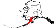 | |
| CDPs | ||
| Ghost town | ||

58°24′N 156°11′W / 58.40°N 156.18°W
| International | |
|---|---|
| National | |