Bungoma
Bungoma | |
|---|---|
Town | |
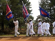
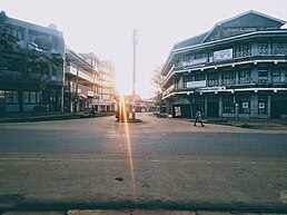
Clockwise from top: Church street, Khetias Crossroads, Bungoma bus park, Kenyatta Avenue. | |
| Coordinates: 00°34′00″N 34°34′00″E / 0.56667°N 34.56667°E | |
| Country | |
| County | Bungoma County |
| Elevation | 4,544 ft (1,385 m) |
| Population (2019 Census)[1] | |
| • Total | 68,031 |
| Time zone | UTC+3 (EAT) |
| Area code | 039 |
| Climate | Am |
Bungoma is the capital of Bungoma County in Kenya. It was established as a trading centre in the early 20th century. It is located in Kenya's fertile Western region and at the foot of Mount Elgon, Kenya's second-tallest mountain. The town and the surrounding areas boast one of Kenya's highest average rainfalls, making Bungoma one of the nation's most important food baskets.
Name[edit]
Bungoma was named from eng'oma, the Bukusu word for "drums". The town was originally a meeting place for Bukusu elders. The sound of drums would emanate from the area as the meeting venue, leading to its eventual naming as Bungoma.[2]
Another account says that long ago the area was occupied by the Bungomek, a clan of the Sabaot. The Bungomek were later driven out by the Bukusu, but the name Bungoma, in reference to their occupation, remained.
Economy[edit]
Farming is the main economic activity in the county. Bungoma County is dependent on sugarcane farming, with one of the country's largest sugar factories as well as numerous small-holder sugar mills. Maize is also grown for subsistence, alongside pearl millet and sorghum. Dairy farming is widely practised, as well as the raising of poultry. There is a small but important tourist circuit, centring on the biennial circumcision ceremonies that are mostly practiced by the Bukusu, Tachoni and Sabaot peoples.[citation needed][3]
Aside from sugar processing, the town also contains various other manufacturing plants such as maize mills, large bakeries, dairy plants and a plastic factory. Other smaller-scale manufacturing activities include steel crafting, iron sheet production, garages and auto repairs.
The services sector is also quite vibrant. There is a busy retail sector dominated by local brands, several banks, insurance companies and large hotels to support the local tourist circuit.
Overview[edit]

The major economic activity in the area is sugarcane farming. This is because more than 67000 farmers directly depend on Nzoia Sugar Company Ltd.[4] Early businesses were supported by the Kenya-Uganda Railway which passes through the town. The collapse of Webuye paper mills and the struggling Nzoia Sugar Company has led to an economic nightmare in the county. Malakisi Ginnery that solely depends on cotton farming in Bungoma County and neighboring counties like Busia has struggled for ages to stand on its feet because of inadequate cotton supplies and few people have embraced cotton farming. Within Malikisi town, British America Tobacco (BAT) also had a well-established leaf buying also contributed and supported the inhabitants of part of Bungoma County that initially had embraced Tobacco farming. Most of the people previously employed there have looked for other jobs while some have totally relocated to other counties.
Major tertiary educational institutions include the Sang'alo Institute of Science and Technology, Mabanga Farmer's training center, SACRED Training Institute, Kibabii University and The Friends School Kamusinga.
The Governor of Bungoma, Kenneth Lusaka, was elected in the 2022 election; he succeeded Wycliffe Wangamati, elected in 2017. Previously the mayor of Bungoma town was Barasa Mbinga of Ford-Kenya, who beat the previous mayor Majimbo Okumu of ODM in the 2009 mayoral election, voted by the Bungoma councilors.[5] The senator of Bungoma is Hon. Moses M. Wetangula.
See also[edit]
The current Bungoma governor is Kenneth Makelo Lusaka after edging out Wycliffe Wangamati in the August 2022 election.
References[edit]
- ^ "2009 Population and Housing Census: Spatial Distribution and Urbanisation Report". Kenya National Bureau of Statistics. Archived from the original on 14 November 2017. Retrieved 26 May 2018.
- ^ Kiruga, Morris. (23 July 2013) "How local dialects influenced naming of west Kenya towns" Daily Nation
- ^ Mabonga, Masolo (29 October 2020). "Bukusu circumcision practices, age groups and dumbfounding myths". Tuko.
- ^ Nzoia Sugar Company [better source needed]
- ^ The Standard, July 3, 2009: ODM loses Bungoma mayoral seat to Ford-Kenya


