
Arlington, Georgia
Arlington, Georgia | |
|---|---|
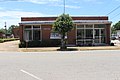
 City hall and police station | |
 Location in Calhoun County and the state of Georgia | |
 Arlington Location in Georgia  Arlington Arlington (the United States)  Arlington Arlington (North America) | |
| Coordinates: 31°26′22″N 84°43′29″W / 31.43944°N 84.72472°W | |
| Country | United States |
| State | Georgia |
| Counties | Calhoun, Early |
| Area | |
| • Total | 4.01 sq mi (10.38 km2) |
| • Land | 4.00 sq mi (10.35 km2) |
| • Water | 0.01 sq mi (0.03 km2) |
| Elevation | 299 ft (91 m) |
| Population (2020) | |
| • Total | 1,209 |
| • Density | 302.48/sq mi (116.79/km2) |
| Time zone | UTC-5 (Eastern (EST)) |
| • Summer (DST) | UTC-4 (EDT) |
| ZIP codes | 31713, 39813 |
| Area code | 229 |
| FIPS code | 13-02928[2] |
| GNIS feature ID | 0310614[3] |
Arlington is a city in Calhoun and Early counties, Georgia, United States. Per the 2020 census, the population was 1,209.[4]
History[edit]
Arlington was founded in 1873, and was chartered in 1881.[5] Arlington served as county seat from 1923 to 1929.[6] The community was named after the Arlington House, the Virginia home of General Robert E. Lee.[6]
Geography[edit]
Arlington is located at 31°26′22″N 84°43′29″W / 31.43944°N 84.72472°W (31.439461, -84.724835).[7] It is located 46 miles northeast of Dothan, Alabama and 45 miles southwest of Albany. According to the United States Census Bureau, the city has a total area of 4.1 square miles (10.7 km2), of which 0.012 square miles (0.03 km2), or 0.24%, is water.[8] it is located in Calhoun and Early counties and borders Baker County to the east.
Demographics[edit]
| Census | Pop. | Note | %± |
|---|---|---|---|
| 1880 | 250 | — | |
| 1890 | 417 | 66.8% | |
| 1900 | 755 | 81.1% | |
| 1910 | 1,308 | 73.2% | |
| 1920 | 1,331 | 1.8% | |
| 1930 | 1,232 | −7.4% | |
| 1940 | 1,337 | 8.5% | |
| 1950 | 1,382 | 3.4% | |
| 1960 | 1,462 | 5.8% | |
| 1970 | 1,698 | 16.1% | |
| 1980 | 1,572 | −7.4% | |
| 1990 | 1,513 | −3.8% | |
| 2000 | 1,602 | 5.9% | |
| 2010 | 1,479 | −7.7% | |
| 2020 | 1,209 | −18.3% | |
| U.S. Decennial Census[9] 1850-1870[10] 1880[11] 1890-1910[12] 1920-1930[13] 1930-1940[14] 1940-1950[15] 1960-1980[16]1980-2000[17] 2010[18] 2020[19] | |||
| Race / Ethnicity | Pop 2010[18] | Pop 2020[19] | % 2010 | % 2020 |
|---|---|---|---|---|
| White alone (NH) | 321 | 214 | 21.70% | 17.70% |
| Black or African American alone (NH) | 1,125 | 964 | 76.06% | 79.74% |
| Native American or Alaska Native alone (NH) | 3 | 2 | 0.20% | 0.17% |
| Asian alone (NH) | 0 | 2 | 0.00% | 0.17% |
| Pacific Islander alone (NH) | 0 | 0 | 0.00% | 0.00% |
| Some Other Race alone (NH) | 1 | 0 | 0.07% | 0.00% |
| Mixed Race/Multi-Racial (NH) | 5 | 9 | 0.34% | 0.74% |
| Hispanic or Latino (any race) | 24 | 18 | 1.62% | 1.49% |
| Total | 1,479 | 1,209 | 100.00% | 100.00% |
In 2010, the city's population was 1,479. By the 2020 census, its population declined to 1,209.
Education[edit]
On Calhoun County's side of the Calhoun County School District unit, Calhoun County Elementary School (grades K-5) serves Calhoun County, including some students from Arlington, Edison, Leary, and Morgan. Calhoun County Middle/High are in Edison. On Early County's side, all schools belong to the Early County School District; elementary, middle, and high schools are in Blakely, including Early County High School.
Notable person[edit]
- James Earl Carter, Sr., farmer, businessman, legislator, father of President Jimmy Carter
Gallery[edit]
-
 Arlington Post Office

References[edit]
- ^ "2020 U.S. Gazetteer Files". United States Census Bureau. Retrieved December 18, 2021.
- ^ "U.S. Census website". United States Census Bureau. Retrieved January 31, 2008.
- ^ "US Board on Geographic Names". United States Geological Survey. October 25, 2007. Retrieved January 31, 2008.
- ^ "Arlington city, Georgia". United States Census Bureau. Retrieved April 15, 2022.
- ^ Krakow, Kenneth K. (1975). Georgia Place-Names: Their History and Origins (PDF). Macon, GA: Winship Press. p. 7. ISBN 0-915430-00-2.
- ^ a b "Calhoun County". New Georgia Encyclopedia. Retrieved April 1, 2018.
- ^ "US Gazetteer files: 2010, 2000, and 1990". United States Census Bureau. February 12, 2011. Retrieved April 23, 2011.
- ^ "Geographic Identifiers: 2010 Demographic Profile Data (G001): Arlington city, Georgia". U.S. Census Bureau, American Factfinder. Archived from the original on February 12, 2020. Retrieved July 17, 2014.
- ^ "Decennial Census of Population and Housing by Decades". US Census Bureau.
- ^ "1870 Census of Population - Georgia" (PDF). US Census Bureau. 1870.
- ^ "1880 Census of Population - Georgia" (PDF). US Census Bureau. 1880.
- ^ "1910 Census of Population - Georgia" (PDF). US Census Bureau. 1930.
- ^ "1930 Census of Population - Georgia" (PDF). US Census Bureau. 1930. p. 253.
- ^ "1940 Census of Population - Georgia" (PDF). US Census Bureau. 1940.
- ^ "1950 Census of Population - Georgia" (PDF). US Census Bureau. 1980.
- ^ "1980 Census of Population - Number of Inhabitants - Georgia" (PDF). US Census Bureau. 1980.
- ^ "2000 Census of Population - General Population Characteristics - Georgia" (PDF). US Census Bureau. 2000.
- ^ a b "P2 Hispanic or Latino, and Not Hispanic or Latino by Race – 2010: DEC Redistricting Data (PL 94-171) – Arlington city, Georgia". United States Census Bureau.
- ^ a b "P2 Hispanic or Latino, and Not Hispanic or Latino by Race – 2020: DEC Redistricting Data (PL 94-171) – Arlington city, Georgia". United States Census Bureau.
Municipalities and communities of Calhoun County, Georgia, United States | ||
|---|---|---|
| Cities |  | |
| Unincorporated communities | ||
| Footnotes | ‡This populated place also has portions in an adjacent county or counties | |
Municipalities and communities of Early County, Georgia, United States | ||
|---|---|---|
| Cities | 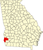 | |
| CDP | ||
| Unincorporated communities | ||
| Footnotes | ‡This populated place also has portions in an adjacent county or counties | |
| Authority control databases: Geographic |
|---|