
Toxey, Alabama
Toxey, Alabama | |
|---|---|
 Location of Toxey in Choctaw County, Alabama. | |
| Coordinates: 31°54′49″N 88°18′30″W / 31.91361°N 88.30833°W | |
| Country | United States |
| State | Alabama |
| County | Choctaw |
| Area | |
| • Total | 0.68 sq mi (1.77 km2) |
| • Land | 0.68 sq mi (1.77 km2) |
| • Water | 0.00 sq mi (0.00 km2) |
| Elevation | 105 ft (32 m) |
| Population (2020) | |
| • Total | 145 |
| • Density | 211.99/sq mi (81.82/km2) |
| Time zone | UTC-6 (Central (CST)) |
| • Summer (DST) | UTC-5 (CDT) |
| ZIP code | 36921 |
| Area code | 251 |
| FIPS code | 01-76632 |
| GNIS feature ID | 2406745[2] |
Toxey is a town in Choctaw County, Alabama, United States. At the 2020 census, the population was 145.
Geography[edit]
Toxey is located south of the center of Choctaw County at 31°54'49.118" North, 88°18'30.485" West (31.913644, -88.308468).[3]
According to the U.S. Census Bureau, the town has a total area of 0.69 square miles (1.8 km2), all land.[4]
Demographics[edit]
| Census | Pop. | Note | %± |
|---|---|---|---|
| 1950 | 251 | — | |
| 1960 | 157 | −37.5% | |
| 1970 | 304 | 93.6% | |
| 1980 | 265 | −12.8% | |
| 1990 | 211 | −20.4% | |
| 2000 | 152 | −28.0% | |
| 2010 | 137 | −9.9% | |
| 2020 | 145 | 5.8% | |
| U.S. Decennial Census[5] 2013 Estimate[6] | |||
As of the census[7] of 2000, there were 152 people, 61 households, and 45 families residing in the town. The population density was 221.9 inhabitants per square mile (85.7/km2). There were 74 housing units at an average density of 108.0 per square mile (41.7/km2). The racial makeup of the town was 86.84% White and 13.16% Black or African American.
There were 61 households, out of which 34.4% had children under the age of 18 living with them, 62.3% were married couples living together, 9.8% had a female householder with no husband present, and 24.6% were non-families. 23.0% of all households were made up of individuals, and 14.8% had someone living alone who was 65 years of age or older. The average household size was 2.49 and the average family size was 2.87.
In the town, the population was spread out, with 29.6% under the age of 18, 3.3% from 18 to 24, 25.7% from 25 to 44, 19.7% from 45 to 64, and 21.7% who were 65 years of age or older. The median age was 39 years. For every 100 females, there were 94.9 males. For every 100 females age 18 and over, there were 81.4 males.
The median income for a household in the town was $23,750, and the median income for a family was $27,143. Males had a median income of $36,250 versus $17,188 for females. The per capita income for the town was $16,244. About 7.1% of families and 13.8% of the population were below the poverty line, including 22.9% of those under the age of eighteen and 29.4% of those 65 or over.
Notable person[edit]
- Mary Monroe, author
References[edit]
- ^ "2020 U.S. Gazetteer Files". United States Census Bureau. Retrieved October 29, 2021.
- ^ a b U.S. Geological Survey Geographic Names Information System: Toxey, Alabama
- ^ "US Gazetteer files: 2010, 2000, and 1990". United States Census Bureau. February 12, 2011. Retrieved April 23, 2011.
- ^ "Geographic Identifiers: 2010 Demographic Profile Data (G001): Toxey town, Alabama". U.S. Census Bureau, American Factfinder. Archived from the original on February 12, 2020. Retrieved June 5, 2014.
- ^ "U.S. Decennial Census". Census.gov. Retrieved June 6, 2013.
- ^ "Annual Estimates of the Resident Population: April 1, 2010 to July 1, 2013". Retrieved June 3, 2014.
- ^ "U.S. Census website". United States Census Bureau. Retrieved January 31, 2008.
External links[edit]
31°54′49″N 88°18′30″W / 31.913644°N 88.308468°W
Municipalities and communities of Choctaw County, Alabama, United States | ||
|---|---|---|
| Towns | 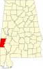 | |
| CDP | ||
| Unincorporated communities | ||
| Footnotes | ‡This populated place also has portions in an adjacent county or counties | |