
Pleasantville, Venango County, Pennsylvania
Pleasantville, Pennsylvania | |
|---|---|
 Pleasantville United Methodist Church | |
 Location of Pleasantville in Venango County, Pennsylvania. | |
 Pleasantville  Pleasantville | |
| Coordinates: 41°35′37″N 79°34′45″W / 41.59361°N 79.57917°W | |
| Country | United States |
| State | Pennsylvania |
| County | Venango |
| Settled | 1821 |
| Incorporated | 1850 |
| Government | |
| • Type | Borough Council |
| Area | |
| • Total | 0.95 sq mi (2.46 km2) |
| • Land | 0.95 sq mi (2.46 km2) |
| • Water | 0.00 sq mi (0.00 km2) |
| Population | |
| • Total | 846 |
| • Density | 890.53/sq mi (343.75/km2) |
| Time zone | UTC-5 (Eastern (EST)) |
| • Summer (DST) | UTC-4 (EDT) |
| Zip code | 16341 |
| Area code | 814 |
| FIPS code | 42-61512 |
| GNIS feature ID | 1215640 |
Pleasantville is a borough in Venango County, Pennsylvania, United States. The population was 841 at the 2020 census,[3] and 892 in 2010. It was an early oil 'boom town', and the population jumped from 291 to 1,598 between 1860 and 1870. But the boom soon passed, and the population shrank to 855 by 1880, and has remained fairly stable since then.
History[edit]
_pic.096_The_Pleasantville_Oil_Field_in_PA_in_1871.jpg)
The Allegheny Baptist Church and Connely-Holeman House are listed on the National Register of Historic Places.[4]
Geography[edit]
Pleasantville is located at 41°35′37″N 79°34′45″W / 41.59361°N 79.57917°W (41.593618, -79.579098).[5]
According to the United States Census Bureau, the borough has a total area of 1.0 square mile (2.5 km2), all land.
Demographics[edit]
| Census | Pop. | Note | %± |
|---|---|---|---|
| 1860 | 291 | — | |
| 1870 | 1,598 | 449.1% | |
| 1880 | 855 | −46.5% | |
| 1890 | 928 | 8.5% | |
| 1900 | 671 | −27.7% | |
| 1910 | 702 | 4.6% | |
| 1920 | 652 | −7.1% | |
| 1930 | 627 | −3.8% | |
| 1940 | 689 | 9.9% | |
| 1950 | 704 | 2.2% | |
| 1960 | 940 | 33.5% | |
| 1970 | 1,005 | 6.9% | |
| 1980 | 1,099 | 9.4% | |
| 1990 | 991 | −9.8% | |
| 2000 | 850 | −14.2% | |
| 2010 | 892 | 4.9% | |
| 2020 | 841 | −5.7% | |
| 2021 (est.) | 832 | [3] | −1.1% |
| Sources:[6][7][8] | |||
As of the census[7] of 2000, there were 850 people, 340 households, and 249 families residing in the borough. The population density was 887.7 inhabitants per square mile (342.7/km2). There were 369 housing units at an average density of 385.4 per square mile (148.8/km2). The racial makeup of the borough was 98.71% White, 0.12% African American, 0.12% Native American, 0.24% Asian, and 0.82% from two or more races. Hispanic or Latino of any race were 0.24% of the population.
There were 340 households, out of which 30.6% had children under the age of 18 living with them, 63.8% were married couples living together, 5.9% had a female householder with no husband present, and 26.5% were non-families. 23.8% of all households were made up of individuals, and 14.7% had someone living alone who was 65 years of age or older. The average household size was 2.50 and the average family size was 2.94.
In the borough the population was spread out, with 24.4% under the age of 18, 7.2% from 18 to 24, 25.5% from 25 to 44, 23.6% from 45 to 64, and 19.3% who were 65 years of age or older. The median age was 40 years. For every 100 females there were 98.1 males. For every 100 females age 18 and over, there were 96.6 males.
The median income for a household in the borough was $32,426, and the median income for a family was $37,679. Males had a median income of $29,722 versus $20,909 for females. The per capita income for the borough was $15,608. About 7.5% of families and 11.4% of the population were below the poverty line, including 18.0% of those under age 18 and 10.4% of those age 65 or over.
Education[edit]
Pleasantville is a part of the Titusville Area School District
References[edit]
- ^ "ArcGIS REST Services Directory". United States Census Bureau. Retrieved October 16, 2022.
- ^ "Census Population API". United States Census Bureau. Retrieved Oct 12, 2022.
- ^ a b Bureau, US Census. "City and Town Population Totals: 2020-2021". Census.gov. US Census Bureau. Retrieved 17 July 2022.
- ^ "National Register Information System". National Register of Historic Places. National Park Service. March 13, 2009.
- ^ "US Gazetteer files: 2010, 2000, and 1990". United States Census Bureau. 2011-02-12. Retrieved 2011-04-23.
- ^ "Census of Population and Housing". U.S. Census Bureau. Retrieved 11 December 2013.
- ^ a b "U.S. Census website". United States Census Bureau. Retrieved 2008-01-31.
- ^ "Incorporated Places and Minor Civil Divisions Datasets: Subcounty Resident Population Estimates: April 1, 2010 to July 1, 2012". Population Estimates. U.S. Census Bureau. Archived from the original on 11 June 2013. Retrieved 11 December 2013.
Municipalities and communities of Venango County, Pennsylvania, United States | ||
|---|---|---|
| Cities | 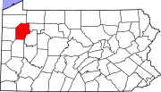 | |
| Boroughs | ||
| Townships | ||
| CDPs | ||
| Unincorporated communities | ||
| Ghost town | ||
| Footnotes | ‡This populated place also has portions in an adjacent county or counties | |
| International | |
|---|---|
| National | |